Brakafjellet etc. (13.01.2019)

| Startsted | Vorland (45moh) |
|---|---|
| Sluttsted | Vorland (45moh) |
| Turtype | Fjelltur |
| Turlengde | 4t 00min |
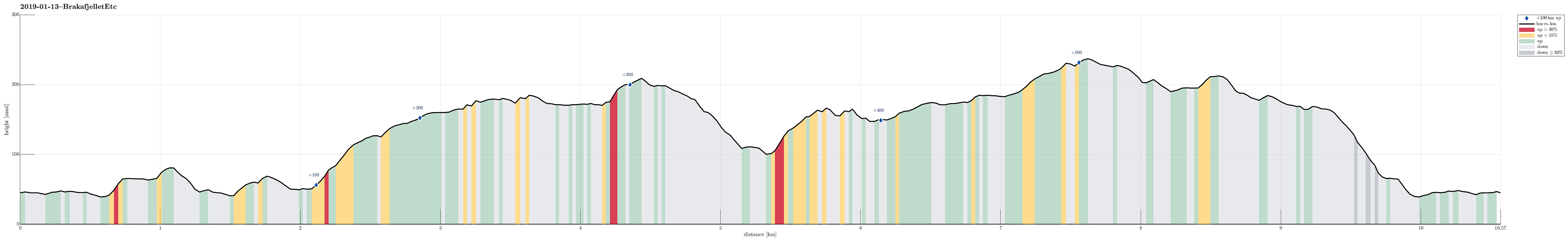
| Distanse | 10,6km |
| Høydemeter | 574m |
| GPS |
|
| Bestigninger | Randifjellet (240moh) | 13.01.2019 |
|---|---|---|
| Storlåsen (211moh) | 13.01.2019 | |
| Vorlandstua (216moh) | 13.01.2019 |
Trip Summary
We expected a few hours of nice weather and thus left home before lunch to get started.
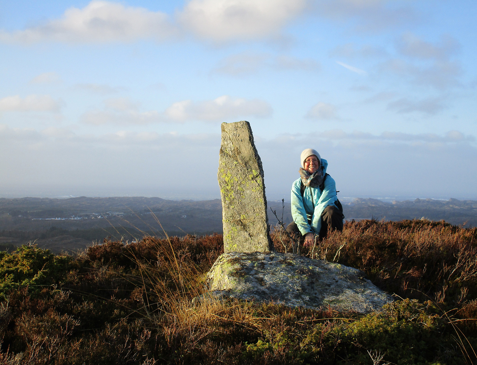
Also this time, our plan was to hike some not so often visited tops in Sund kommune. We took road 555 to Sotra and then further to the south until we came to a small place called Vorland. There, we parked and started our hike along Gjerdevegen (in eastern direction). Soon behind the last house at Gjerdevegen we crossed over some wet terrain (still in eastern direction), in order to connect to a simple path that then continues in northeastern direction (towards Kleiva). At Kleiva, we departed from the trail and continued in northeaster direction through a little valley. We continued through a trough into the direction of Djupeskarvatnet (all this without a path). At Djupeskarvatnet, we connected to another simple path, which we had used already once before, but this time we hiked Djupskaret up (not down). At the top of Djupskaret, we turned right, this time, and started our ascend to Brakafjellet -- now in southeastern direction. Brakafjellet is a rather long ridge, aligned northwest--southeast, and there isn't any real path over it. Still, we found a simple way to get up to the top of the ridge. Then, we followed the ridge all the way towards Skiftesvarden (across Eidesbrota). Mostly, this was easy and straight-forward, but occasionally, we needed to look carefully for finding a way to continue. At Eidesbrota, also, the ridge is partially exposed and since we were going in stormy weather, this was a little challenging, altogether. From Skiftesvarden, we descended (still in southeastern direction) towards Storelåsvatnet, which we then passed on its western side. Only a few steps further south (than the southernmost tip of lake Storelåsvatnet) we then connected to a path that then brought us up to Storlåsen. We continued over the top along the path even though it brought us quite a bit too far east and down. As soon as we came to a somewhat flatter spot (at about 110mosl), where it seemed reasonable to turn right (in southwestern direction), we did so, following a minor path over a local saddle there. This brought us down into a narrow and wet valley, where we decided that we should do something to get back up to the path that we originally had planned to follow further to Randifjellet. Very soon, we found that ascending through the valley would (a) be nontrivial due to all the vegetation there and (b) bring us too far back (underneath Storlåsen). Thus, we fought ourselves up rather steeply (in western direction) to get up to a local ridge there. Once up there, however, we found something that could count as a minor trail and we followed it successfully for a while. Near Hestatjørna, we first wanted to cut short the trail (north of Hestatjørna), just to find out that the terrain was too steep there. Thus, we rounded a small hill (north of Hestatjørna) to connect to the path, which we intended to find. We then followed this path (in southern direction) to a point near Tangavatnet / Nyatrævatnet, where we found the path that would bring us up to Randifjellet. This path was easy to follow and we soon after found ourselves on the top of Randifjellet. Here, somewhat higher up, we experienced the stormy conditions again and we had to fight our way against the wind! From Randifjellet, we continued along the path and connected to Vorlandstua this way. We then continued along the path (further in northwestern direction) and descended via Svartaberget to Vorland (and Gjerdevegen). Soon after, we returned to our car. All in all, this was a partially challenging hike (quite a bit without any path) and also a very wet one (in many places, the path was submerged in many centimeter deep water). Still, we were very satisfied in the end and find it rewarding to explore these somewhat not so often visited back-country spots on Sotra! :-)
Photos
Selected photos are available as Google photo album.
Useful Resources
See also the related FB-page Hiking around Bergen, Norway.

Kommentarer