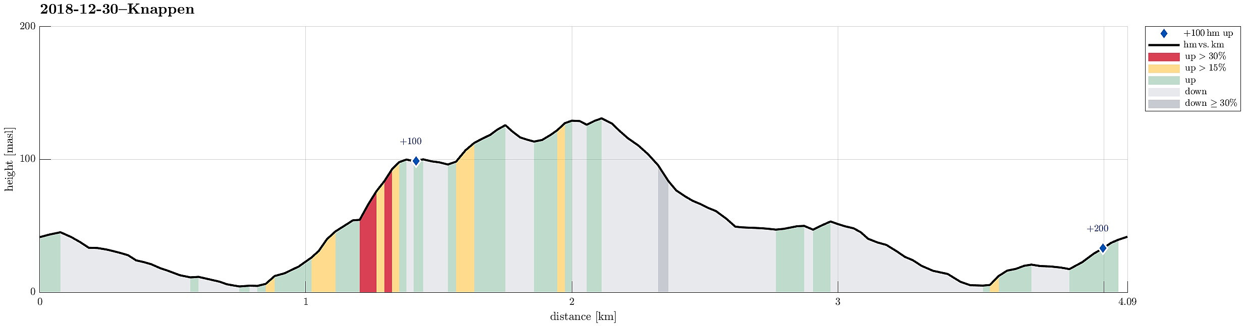
Knappen (30.12.2018)

| Start point | Varden (45m) |
|---|---|
| Endpoint | Varden (45m) |
| Characteristic | Hillwalk |
| Duration | 1h 00min |
| Distance | 4.1km |
| Vertical meters | 209m |
| GPS |
|
| Ascents | Eldtona (128m) | 30.12.2018 |
|---|---|---|
| Knappen (135m) | 30.12.2018 |
Trip Summary
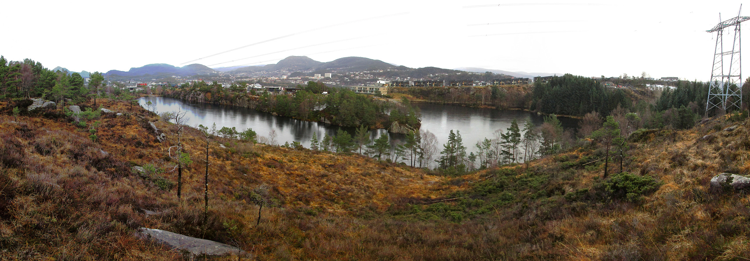
We only had a bit of time to get some fresh air and thus decided to do Knappen, once again. :-) We started from Varden, descended to Bjørgeveien first, before then using Sandeidbrotet to connect to a path that would lead us further up and towards Knappen. Once up on the heights (still in the very north of Knappen), we this time followed a minor (and wet) path more towards the northeastern side of the "Knappen-plateau" (than the more usual path on the western side). Halfway along this path, however, we decided that we would still cross over to the "top" of Eldtona, before continuing further to Knappen. Once on Knappen, we this time chose the path leading (more or less) directly down to Knappatjørna (in eastern direction). Before actually getting all the way down, however, we this time turned left (in northern direction) and passed by Knappatjøran on its western side (usually, we would go on the other side, where also a proper gravel road is found). Rounding the north tip of Knappatjørna, we quickly connected to Vassteigen and followed the road from there back to Varden.
Useful Resources
See also the related FB-page Hiking around Bergen, Norway.
Petter Bjørstad has a useful page about Knappen.

User comments