After-flight hike to Knappen (05.08.2018)

| Start point | Varden (45m) |
|---|---|
| Endpoint | Varden (45m) |
| Characteristic | Hillwalk |
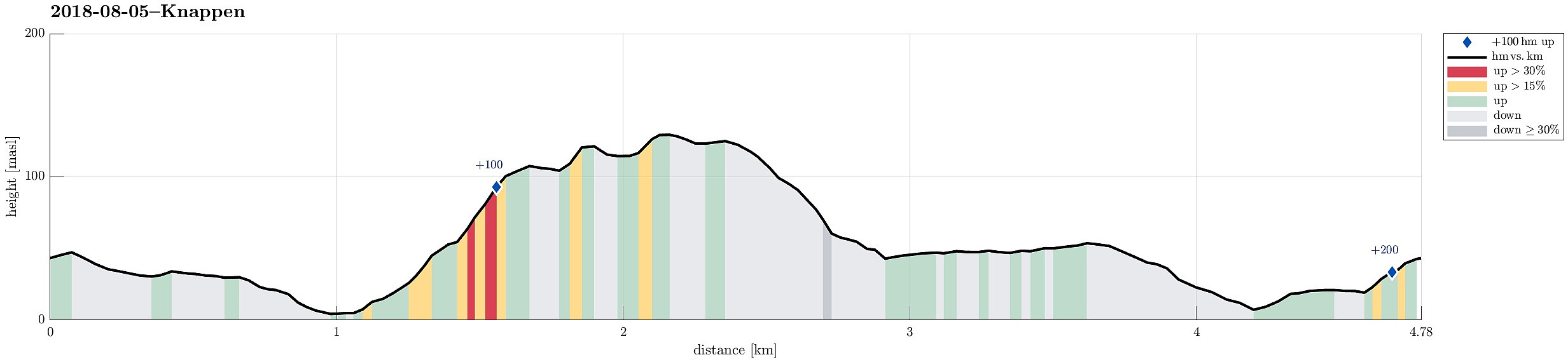
| Duration | 2h 00min |
| Distance | 4.8km |
| Vertical meters | 212m |
| GPS |
|
| Ascents | Eldtona (128m) | 05.08.2018 |
|---|---|---|
| Knappen (135m) | 05.08.2018 |
Trip Summary
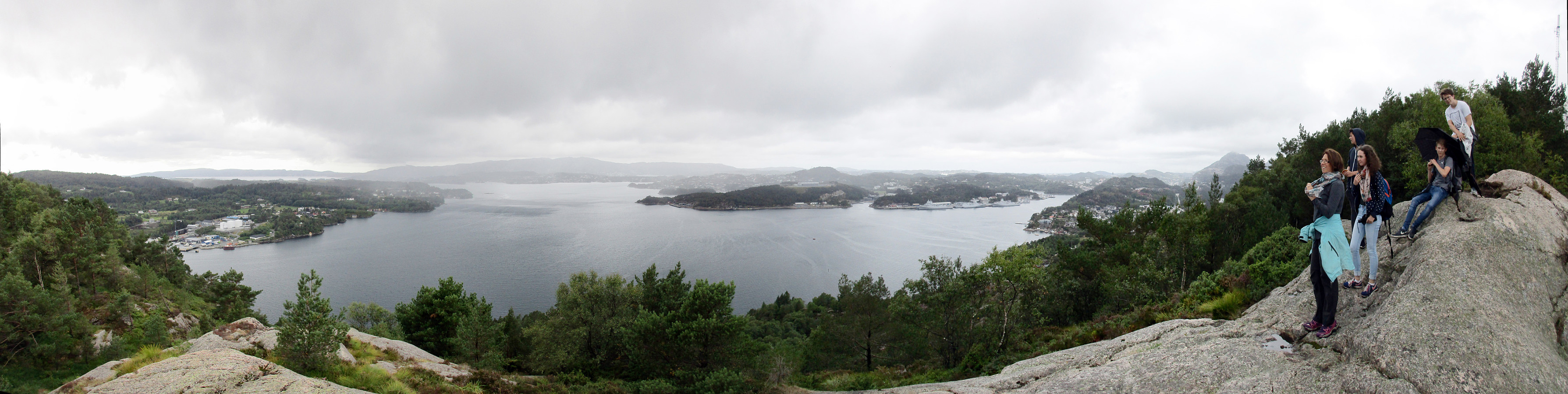
To stretch our legs a little bit, we decided to make a quick hike over Knappen, ignoring the fact that it rained (more or less). We started from Varden, went first towards Gjeddevatnet, before we went down to Bjørgeveien and from there further to Sandeidbrotet. From there, we continued via a nice path, leading first up to Eldtona, before from there connecting to Såta, the highest point in Knappen (not very high, after all). After enjoying a bit of a view of Grimstadfjorden, we descended to the southern end of Knappetjørna. Before returning back to Varden via Vassteigen, we dived for a short swim into Knappetjørna. All in all, even though the weather was suboptimal, this was a refreshing excursion at the end of the day.
Useful Resources
See also the related FB-page Hiking around Bergen, Norway.
Petter Bjørstad has a useful page about Knappen.

User comments