Biking through the Alps 2: Defereggen-Misurina (25.08.1998)

| Start point | Bruggen (1,315m) |
|---|---|
| Endpoint | Misurina (1,755m) |
| Characteristic | Bike trip |
| Duration | 9h 00min |
| Distance | 81.6km |
| Vertical meters | 2,672m |
| GPS |
|
| Visits of other PBEs | Col Sant Angelo (1,756m) | 25.08.1998 |
|---|---|---|
| Plätzwiese (1,980m) | 25.08.1998 | |
| Stallersattel (2,040m) | 25.08.1998 |
Trip Summary
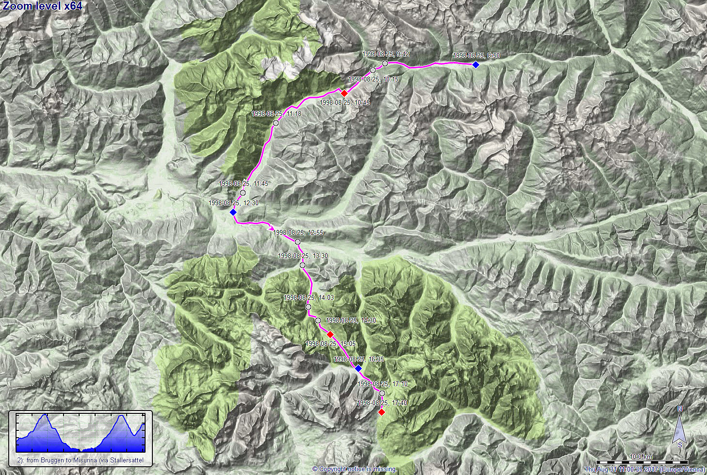
Day 2 of this multi-day bike-trip through the Alps should bring us from Austria to Südtirol, Italy. To do so, we had the plan to cross the 2040m high Stallersattel, coming from Defereggen. About two hours after having started in Bruggen (at about 1315mosl), we arrived at Stallersattel and enjoyed the beautiful mountain landscape there with satisfaction. :-) What followed, was a fast and long descent into the Antholzer valley (southwest of Stallersattel and already in Südtirol, Italy). At about noon-time, we were down at about 1000mosl, again, and turned left into the Pustertal (basically towards the east!). After a relatively short stretch in this comparably busy valley, we turned right, again (into southern direction), entering the Pragser valley with the plan to cycle up to Plätzwiesen at about 1965mosl (almost as high as Stallersattel). About two hours later, we arrive at the saddle (not open to cars). Our plan was to continue further (into southeastern direction from Plätzwiesen), but since there was not really a paved road down from Plätzwiesen on this other side, we had to improvise a little. Back down on the road in Schluderbach (at about 1500mosl), we started our last (somehow smaller) ascent on this day in order to get to Misurina, where we stopped for the night (at about 1750mosl).
Tour Info
More details about the entire bike-trip are available via a separate web page.
Useful Resources
Route details about four longer bike rides in/near the Alps are summarized on a separate web page.
See also the related FB-page Hiking around Bergen, Norway.

User comments