Knappen (05.03.2017)

| Startpunkt | Varden (45m) |
|---|---|
| Endpunkt | Varden (45m) |
| Tourcharakter | Bergtour |
| Tourlänge | 1h 00min |
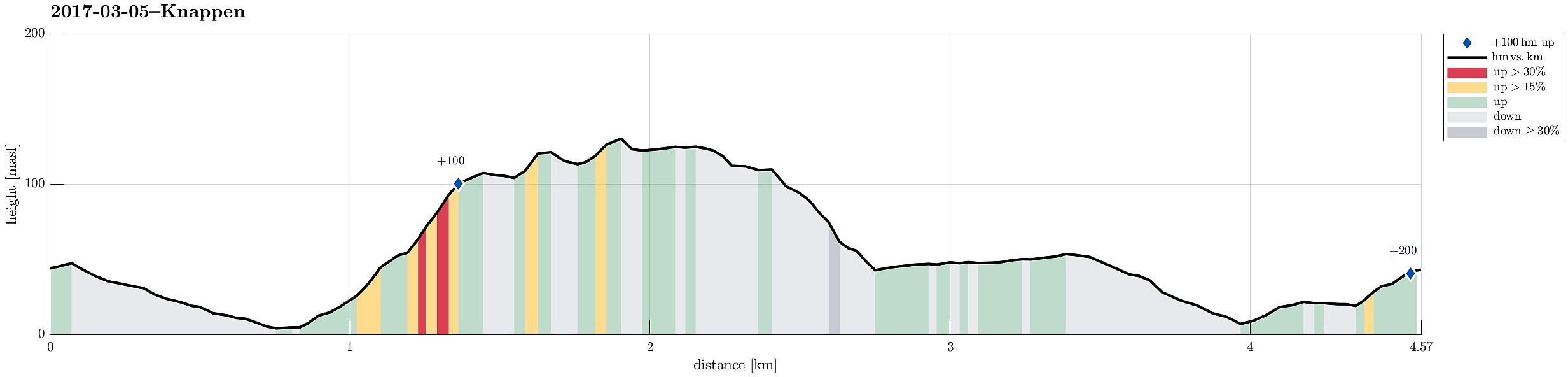
| Entfernung | 4,6km |
| Höhenmeter | 203m |
| GPS |
|
| Besteigungen | Eldtona (128m) | 05.03.2017 |
|---|---|---|
| Knappen (135m) | 05.03.2017 |
Trip Summary
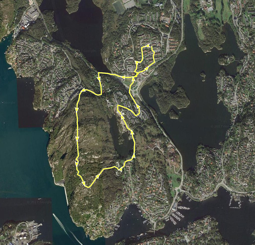
We started at Varden, walking down Marineveien and further on Bjørgeveien, where we turned left into Sandeidbrotet, leading steeply upwards (in the direction of Knappatjørna). At "the top", where the street makes a sharp turn to the left, a hiking path leaves to the right (only a few meters above another side-road, which only connects to a private place). Following the hiking path (into northwestern direction) brings one nearby Røstafjellet, i.e., another residential area north of Knappen and slightly elevated above Bjørgeveien. Before actually entering this area, another hiking path leaves to the left and upwards, first in western direction, but then, following the ridge, turning more and more into southern direction. Once on the ridge, the path follows the heights up to Knappen and one can enjoy some nice views (mostly in western direction). On Knappen, we continued a little bit further, visiting some of the war ruins which still "beautify" the top of Knappen. South of Knappen, we then used a hill-side, cleared from trees because of an overhead power line, to get back to a track which connects to the place of the previous psychiatric station south of Knappatjørna. We then continued around Knappatjørna and connected to Vassteigen on the eastern side of this little lake. There, we simply followed the road down and connected via the pedestrians bridge over to Varden. This December hike in wet conditions was refreshing!
Useful Resources
See also the related FB-page Hiking around Bergen, Norway.
Petter Bjørstad has a useful page about Knappen.

Benutzerkommentare