Langtrotten on Algrøyna---wild! :-) (30.07.2016)

| Startsted | Bus stop Urhaugen on Algrøyna (18moh) |
|---|---|
| Sluttsted | Bus stop Urhaugen on Algrøyna (18moh) |
| Turtype | Fjelltur |
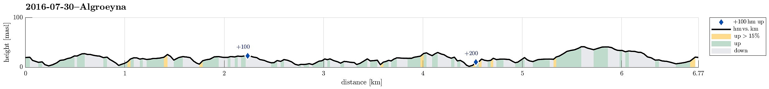
| Turlengde | 4t 00min |
| Distanse | 6,8km |
| Høydemeter | 285m |
| GPS |
|
| Andre besøkte PBE'er | Algrøyna parkering (20moh) | 30.07.2016 |
|---|---|---|
| Langtrotten (22moh) | 30.07.2016 | |
| Trollskogen (15moh) | 30.07.2016 |
Trip Summary
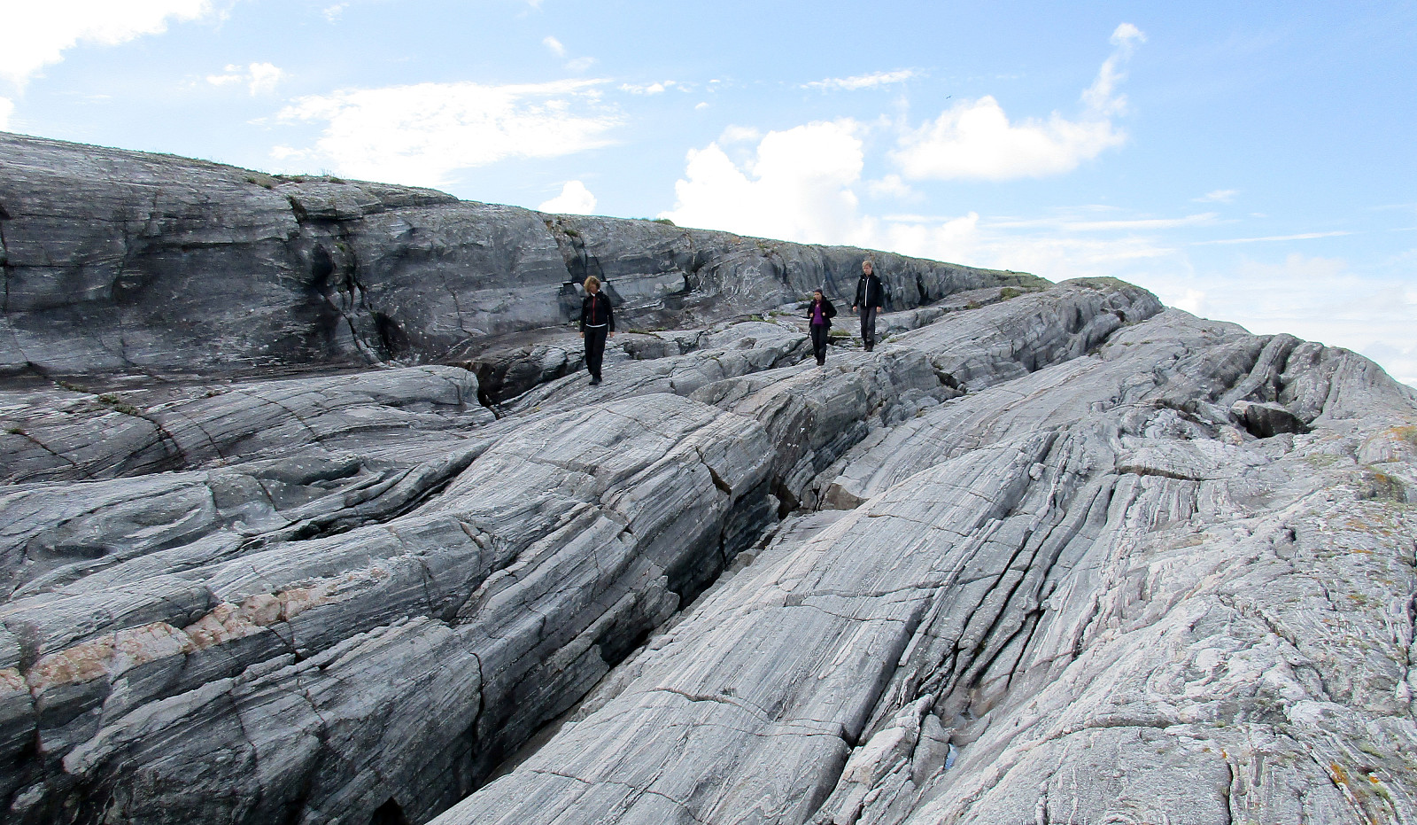
We parked near the bus stop Urhaugen (almost the last one on Algrøyna) and walked from there, first continuing on the road (Nordre Øyavegen, then Kongvikvegen). Near house #51 along Kongvikvegen, one leaves the road and descends down towards the eastern end of Kungvika. There, following one of the paths, we crossed over to the other, southern side that connects to Barmaneset, i.e., the middle of the three "fingers" of Algrøyna. Following the path, we walked westwards, between Urhaugen and Måshaugane, and continuing across Nordra Mynteidet further west and onto Barmaneset. The path leads to the innermost bay of Krabbakeila, where it isn't 100% obvious of how to continue further towards Langtrotten (one has to turn left, basically, walk down, across, and up again, and sneek through some narrow passage, where a few trees are also found). Back on course towards west (Langtrotten) one gets up again and further to the part south of Krabbakeila, where vegetation becomes minial and a wild landscape of rocks unfolds. If one intends to reach the outermost parts of Langtrotten, then it is recommended to stay more on the northern side of this part (instead of climbing the slightly higher rocks in the middle/south). Before reaching the outhermost parts of Langtrotten, a major gap between the rocks cuts from north to south and only on the norther part it is reasonably possible to jump over from east to west (and back). We then enjoyed a short break on the wild outer part of Langtrotten, before returning (first the same way that we came). Back on Barmaneset, however, we took an alternative path back, which leads eastward more or less in parallel to the path that we had taken out, first. At the place, where Nordra Mynteidet is just a few meters in the north, we turned right (southwards) to round Kvernhushaugen and to get to the southern side of Storavatnet. We then walked around Storavatnet on its southern side, connecting to anonther path that joins from the south. Nearby, right between Lundevatnet and Storavatnet, a nice resting place is found with opportunities for the youngest hikers to play and enjoy themselves! :-) And only meters from there, where a few trees gather together, someone made major efforts to make this little forrest interesting for the youngest, also! :-) From there, it was then only minutes back to the road and the car. All in all, this little island of Algrøyna is really worth the trip with wild nature, good walking paths, and even some playing ground in the middle of all that! :-)
Photos
Selected photos are available as Google photo album.
Useful Resources
See also the related FB-page Hiking around Bergen, Norway.

Kommentarer