Møsnuken (17.04.2016)

| Startsted | Tyssdal (50moh) |
|---|---|
| Sluttsted | Tyssdal (50moh) |
| Turtype | Fjelltur |
| Turlengde | 5t 00min |
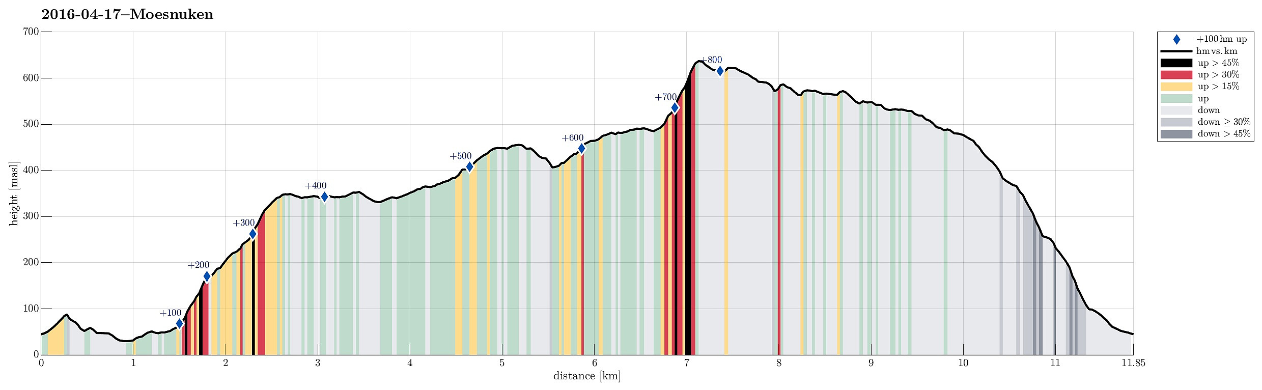
| Distanse | 11,8km |
| Høydemeter | 871m |
| GPS |
|
| Bestigninger | Borgafjellet (353moh) | 17.04.2016 |
|---|---|---|
| Hegglandsfjellet (459moh) | 17.04.2016 | |
| Møsnuken (639moh) | 17.04.2016 | |
| Storafjellet (592moh) | 17.04.2016 | |
| Søre Såta (578moh) | 17.04.2016 | |
| Andre besøkte PBE'er | Borgly (354moh) | 17.04.2016 |
| Knutabruo (37moh) | 17.04.2016 | |
| Linken (486moh) | 17.04.2016 | |
| Tøsdalen parkering (60moh) | 17.04.2016 |
Trip Summary
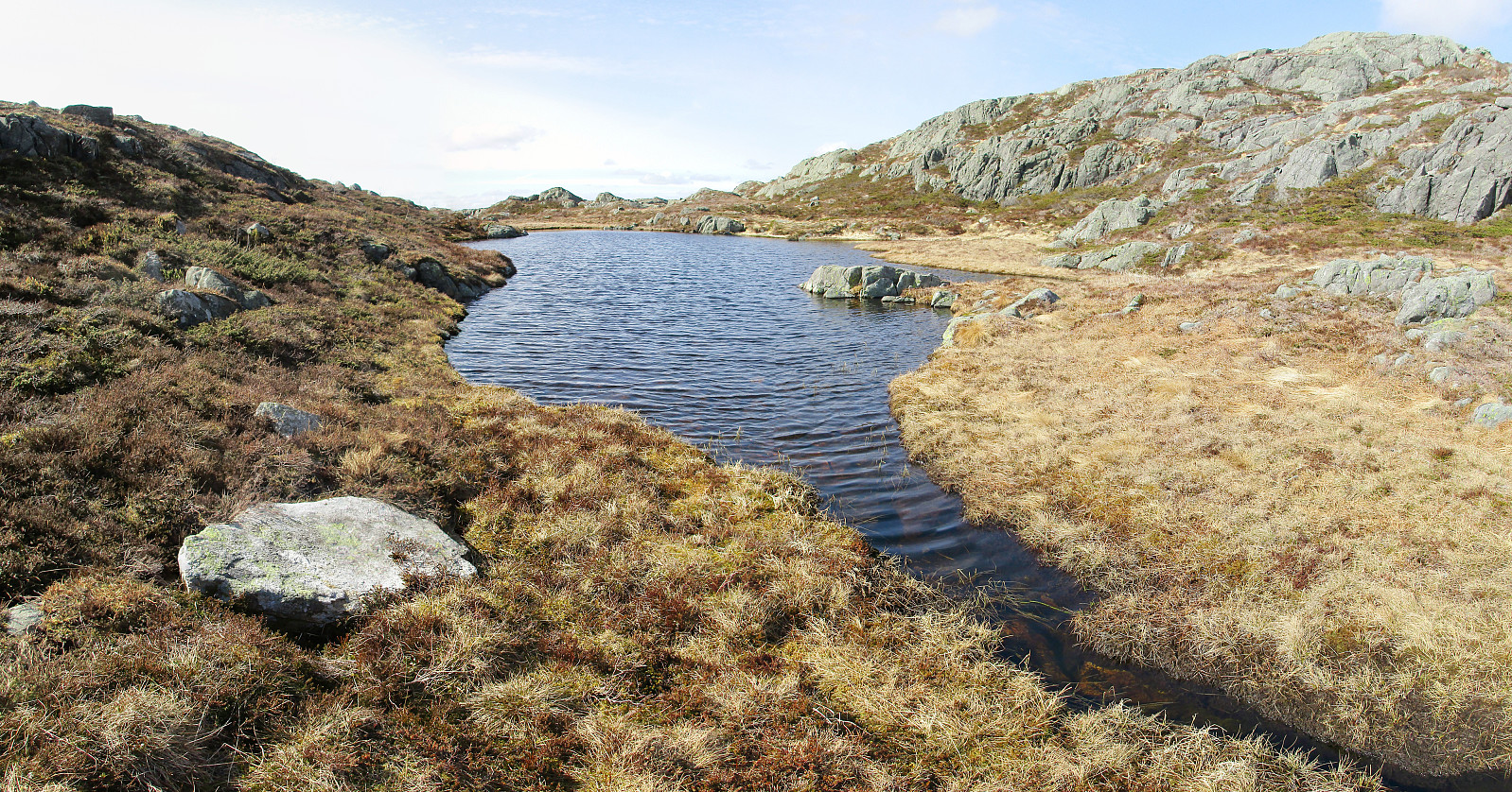
We took road E39 southwards from Bergen, passing by Kalandsvatnet and driving all the way to Ulven (near Os), where we turned left (right next to a gas station), finding the small road connecting to Tyssdal. On the other side of Oselva, near the point, where Tyssdalselva is coming down from Møsnuken, we found a parking place and started to hike from there. Since we wished to start with Borgafjellet, this time, we first tried to connect to the gravel road that connects Tyssdal with Os (right next to Oselva, on its eastern side). We could have done this "the easy way" :-) -- instead, we walked up to the houses on the hillside south of Tyssdal. Up there, we understood that we were too high and descended the few meters down to the gravel road through the forest. Following the gravel road, then, we discovered something new: a new suspension bridge (for pedestrians only) that crosses Oselva at a nice vantage point -- wow! :-) Back to the gravel road, we continued along it until we came to the first houses. Instead of following the street from there, we surrounded a wet area to our left, walking along a (sort of) forest road. Our plan was to ascend in southern direction and along the steep cliffs to our left so that we would connect to the hiking path up Borgafjellet already at some nice height (avoiding the longer way around and up from below). The plan worked out well, but it's recommended to have a good notion of where to go, since no paths whatsoever became apparent to us along this short stretch. Once around "the nose", we first got to see a nice overview over Os and Fusafjorden, before we connected to the hiking path (as planned). This very good path lead us up to Borgafjellet in short time and we enjoyed the great views (in all directions) from up there. From Borgafjellet, we then went to get to Møsnuken and our path crossed the heights in between, including Høgehaugen, Snøkkekampen, and Hegglandsfjellet. It's easy to walk up there and there are many spots for taking photos! :-) At Gryteskaret, between Snøkkekampen and Hegglandsfjellet, one needs to decide between continuing along the "main path" (which leads into the valley of Tyssdalselva, first, before then connecting further) or turning right (towards east) and following a less visible path up Hegglandsfjellet. We did the latter and had some additional nice views from there. On Hegglandsfjellet, however, the almost invisible path became completely invisible and we had to find our own way down into a lovely valley, where also Hegglandstjørna lies. We followed the little stream (Kvernelva?) upwards (towards Tyssdalsfjellet) until we connected to the west-east-axis that begins with Tyssdalselva at Tyssdal in the west. Not long along this path, then, we came to the point, where one needs to decide between the more direct route up Møsnuken (over the stones and steeply up) or for the "Møsnuken from behind" variant that ascends to the top from the east. We followed our original plan and did the latter, walking first through Øvste Stemmedalen (with a nice little lake right underneath Møsnuken). The the right point (it's well labeled!), one turns left and begins the ascent to Møsnuken (which is also steep, but no problem at all). At the top of Møsnuken, we started to face some significant (cold) wind, which motivated us to only make a short break in a somewhat sheltered area. Soon, we started or hike back (towards Tyssdal, after all). Our plan was to walk all over the high ridge (instead of descending into the valley of Tyssdalselva right away). This is easily accomplished, but one needs to spot the point, where to deviate from the main path (it's quite obvious, still). We came by Tyssdalsfjellet (did not really make it to the very top, though, since our path passed by it more than crossing over it) and continued via the high area towards west. Before it starts to go down more steeply, again, we also came by this surprisingly looking big white square -- what really is this good for? :-) Eventually, we followed a nice path down from there and connecting to Tyssdal at the very bottom of the mountain. All in all, this was a slightly longer, but nevertheless very nice hike with great views in all directions! :-)
Photos
Selected photos are available as Google photo album.
Useful Resources
See also the related FB-page Hiking around Bergen, Norway.
Web page WestCoastPeaks.com provides useful information about Møsnuken and Tyssdalsfjellet
and also Petter Bjørstad has a useful page about Møsnuken.
Web page UT.no from the Norwegian Trekking Association recommends another hike up and down Tyssdalsfjellet (Møsnuken).

Kommentarer