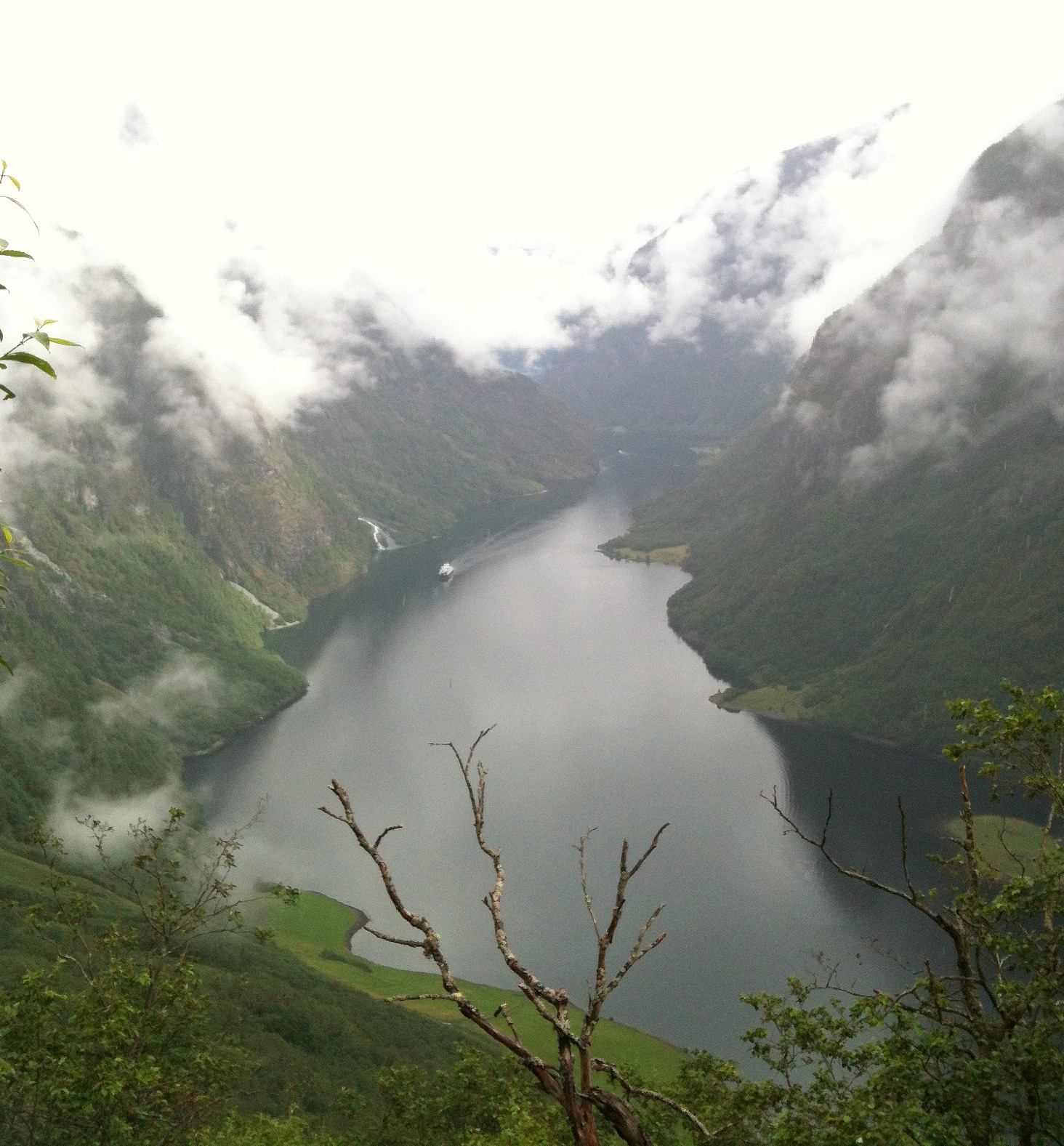
Rimstigen (12.07.2012)

| Startsted | Bakka (10moh) |
|---|---|
| Sluttsted | Bakka (10moh) |
| Turtype | Fjelltur |
| Turlengde | 3t 00min |
| Distanse | 9,2km |
| Høydemeter | 1145m |
| GPS |
|
| Andre besøkte PBE'er | Skarsvotni (1097moh) | 12.07.2012 |
|---|
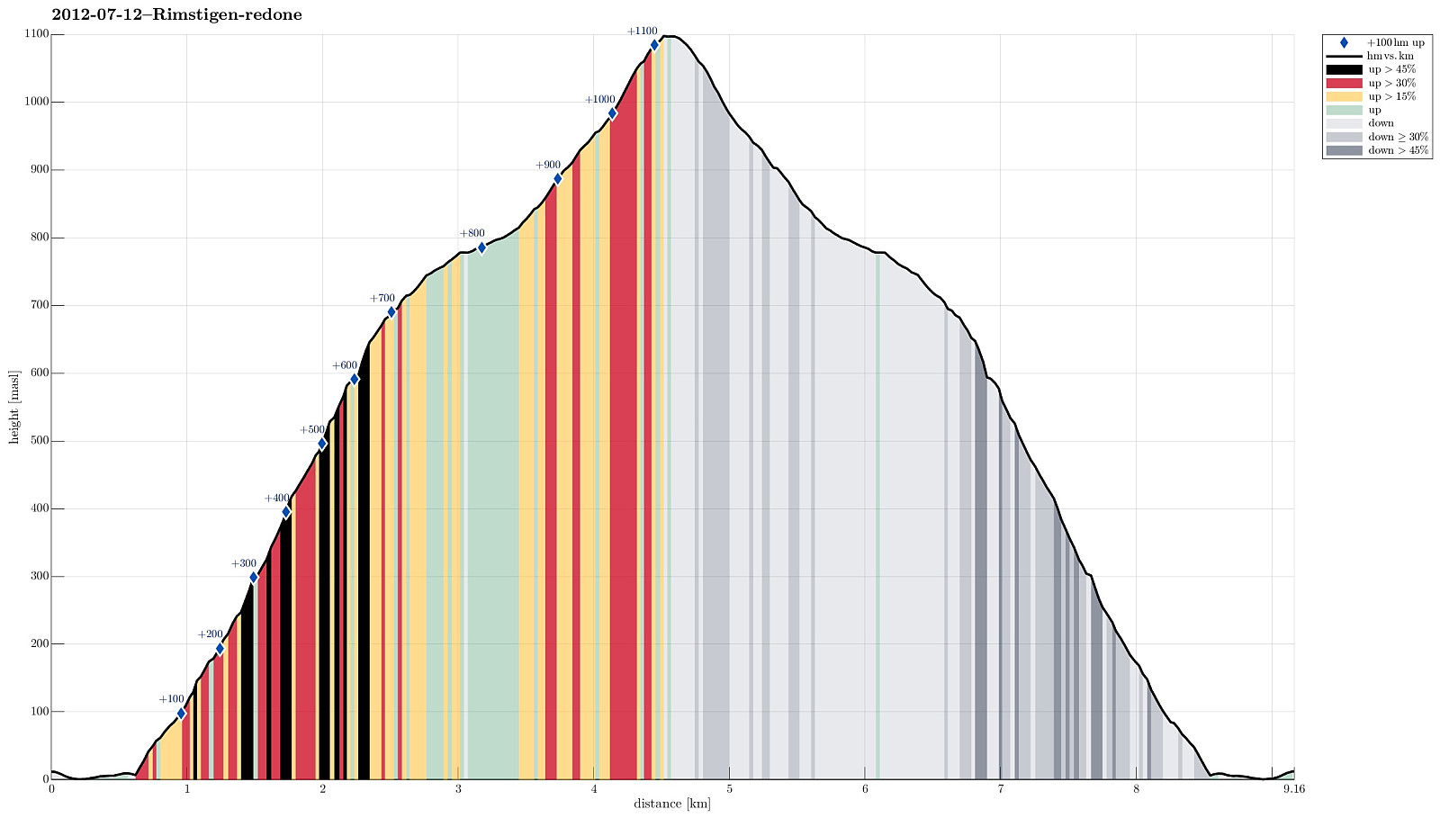
Note that this track has been created a posteriori, i.e., from memory, not automatically recorded.
Trip Summary
Wonderful hike up and down Rimstigen!
Photos
Selected photos are available as G+ photo album.

Kommentarer