Hausdalshorgi (08.10.2011)

| Startpunkt | Øvstebøvegen (250m) |
|---|---|
| Endpunkt | Øvstebøvegen (250m) |
| Tourcharakter | Bergtour |
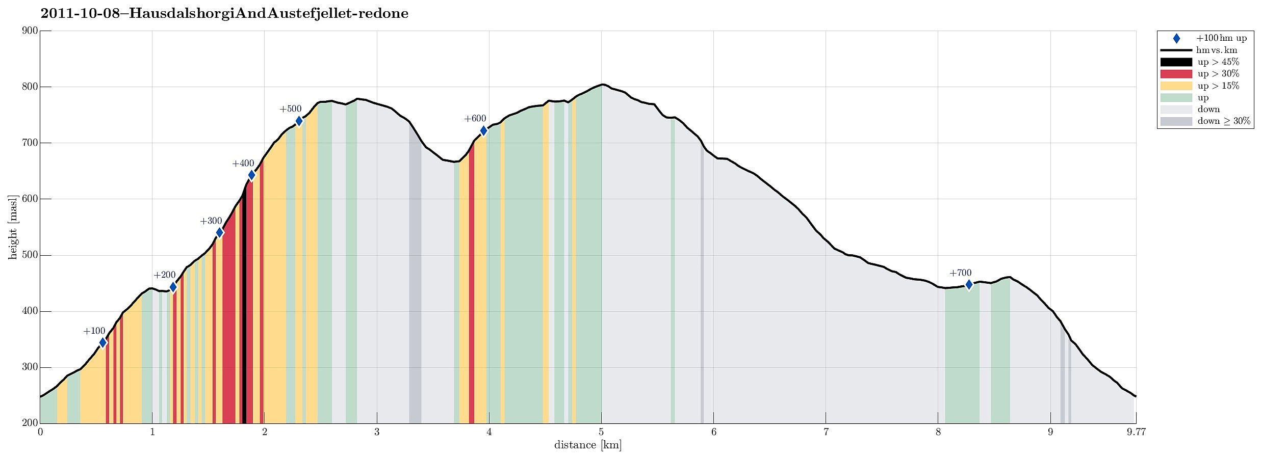
| Tourlänge | 4h 00min |
| Entfernung | 9,8km |
| Höhenmeter | 717m |
| GPS |
|
| Besteigungen | Austefjellet (806m) | 08.10.2011 |
|---|---|---|
| Hausdalshorga (781m) | 08.10.2011 | |
| Besuche anderer PBE | Dyrdalsvatnet (435m) | 08.10.2011 |
| Varden på Hausdalshorga (775m) | 08.10.2011 |

Note that this track has been created a posteriori, i.e., from memory, not automatically recorded.
Trip Summary
Very nice hike via Hausdalshorgi to Austefjellet and then back via Dyrdalsvatnet!
Photos
Selected photos are available as G+ photo album.

Benutzerkommentare