Cycling near Raabs/Thaya (13.07.2010)

| Startpunkt | Liebnitz (430m) |
|---|---|
| Endpunkt | Liebnitz (430m) |
| Tourcharakter | Fahrradtour |
| Tourlänge | 2h 00min |
| Entfernung | 28,9km |
| Höhenmeter | 556m |
| GPS |
|
| Besuche anderer PBE | Ruine Kollmitz (420m) | 13.07.2010 |
|---|
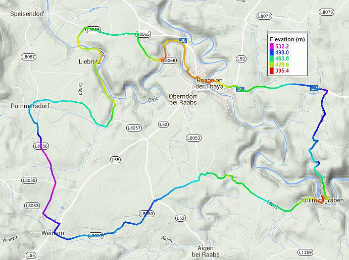
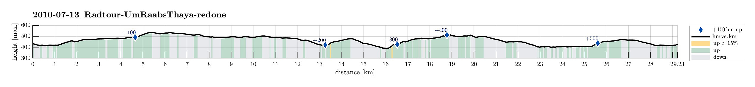
Note that this track has been created a posteriori, i.e., from memory, not automatically recorded.
Nice cycling round near Raabs/Thaya.

Benutzerkommentare