Løvstakken from/to Krohnegården (28.03.2015)

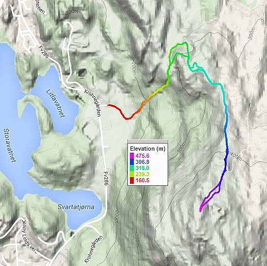
| Start point | Krohnegården (160m) |
|---|---|
| Endpoint | Krohnegården (160m) |
| Characteristic | Hillwalk |
| Duration | 1h 00min |
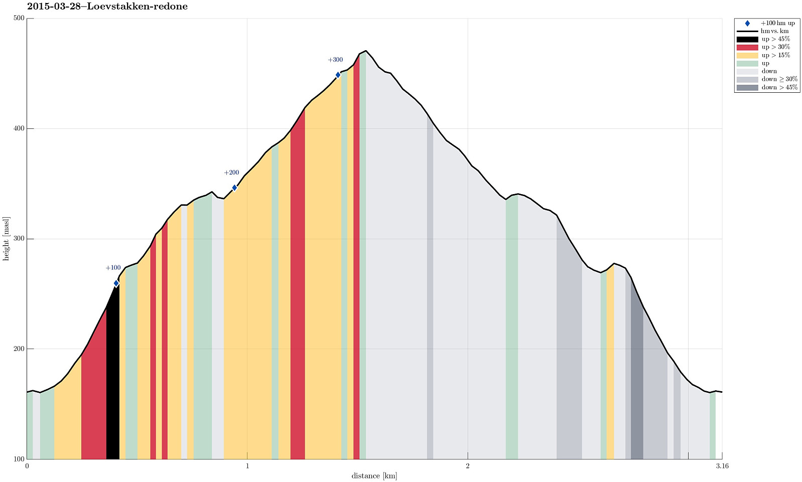
| Distance | 3.2km |
| Vertical meters | 344m |
| GPS |
|
| Ascents | Løvstakken (478m) | 28.03.2015 |
|---|---|---|
| Visits of other PBEs | Fjellheim (tuft), Løvstakken (286m) | 28.03.2015 |
| Krohnegården p-plass (160m) | 28.03.2015 |
Note that this track has been created a posteriori, i.e., from memory, not automatically recorded.
Trip Summary
Simple, quick, and refreshing short hike up and down Løvstakken (from Krohnegården)
Useful Resources
Web page WestCoastPeaks.com provides useful information about Løvstakken.

User comments