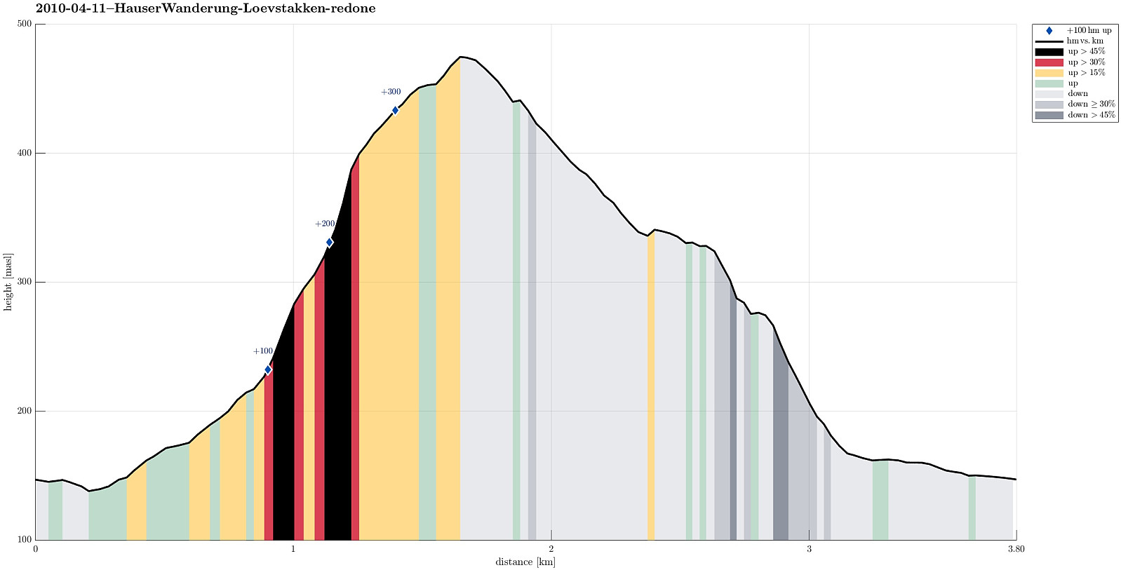
Løvstakken (11.04.2010)

| Startpunkt | Svartatjørna (150m) |
|---|---|
| Endpunkt | Svartatjørna (150m) |
| Tourcharakter | Bergtour |
| Tourlänge | 1h 00min |
| Entfernung | 3,6km |
| Höhenmeter | 359m |
| GPS |
|
| Besteigungen | Løvstakken (478m) | 11.04.2010 |
|---|---|---|
| Besuche anderer PBE | Krohnegården p-plass (160m) | 11.04.2010 |
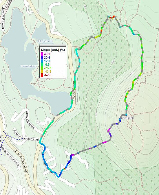
Note that this track has been created a posteriori, i.e., from memory, not automatically recorded.
Trip Summary
Up and down Løvstakken from Svartatjørna.
Useful Resources
Web page WestCoastPeaks.com provides useful information about Løvstakken.

Benutzerkommentare