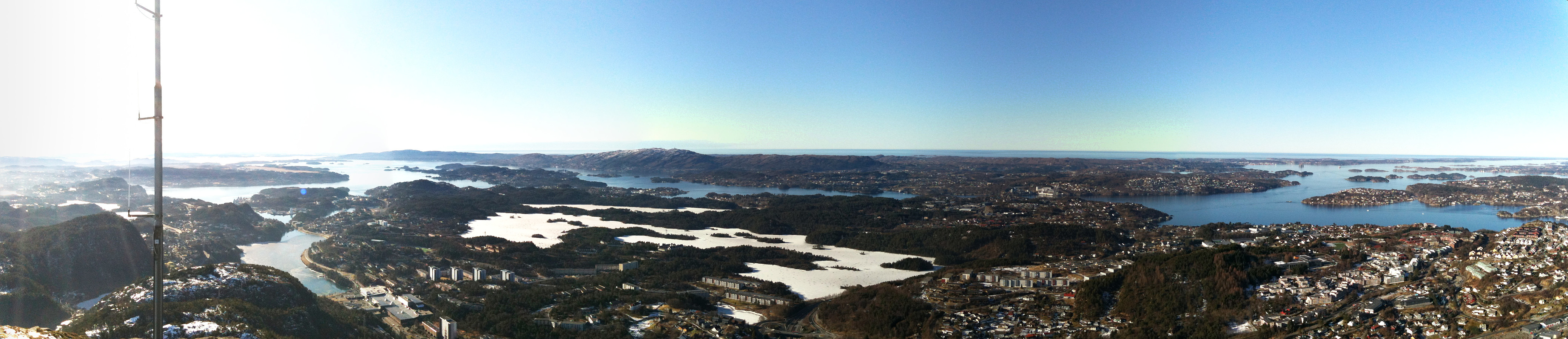
Lyderhorn (23.02.2013)

| Startpunkt | Kjøkkelvik (25m) |
|---|---|
| Endpunkt | Kjøkkelvik (25m) |
| Tourcharakter | Bergtour |
| Tourlänge | 1h 30min |
| Entfernung | 5,6km |
| Höhenmeter | 406m |
| GPS |
|
| Besteigungen | Lyderhorn (396m) | 23.02.2013 |
|---|
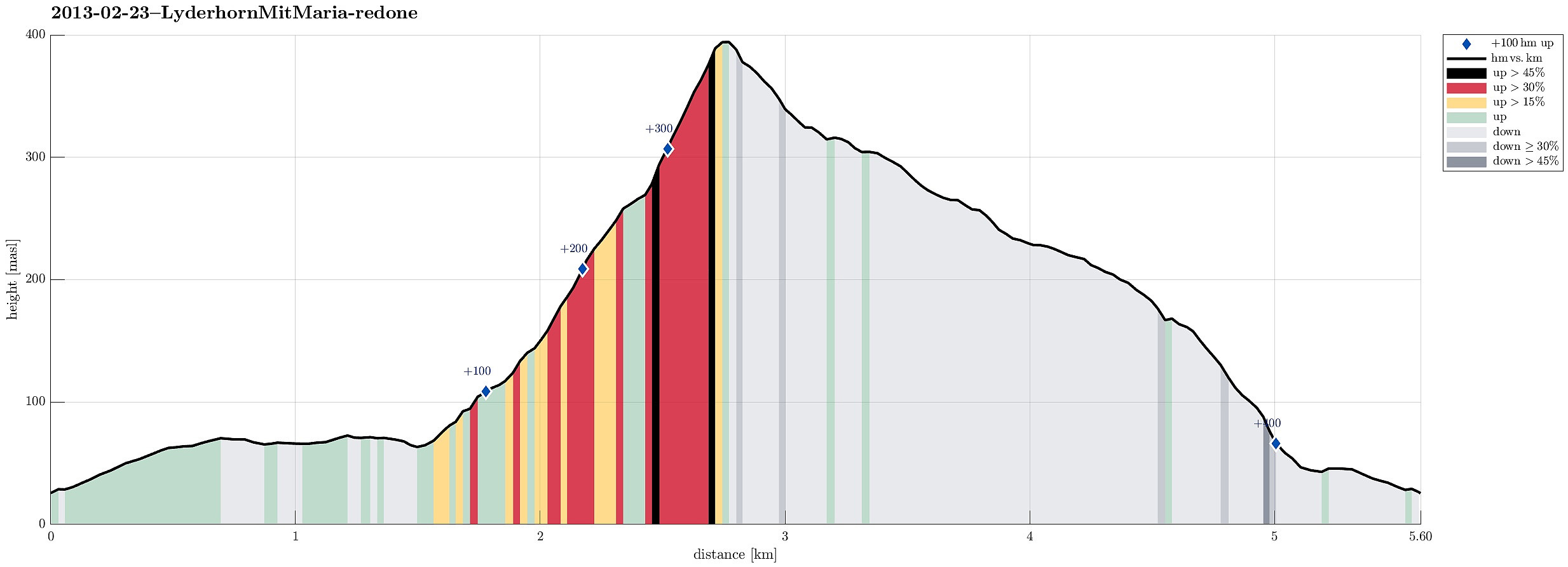
Note that this track has been created a posteriori, i.e., from memory, not automatically recorded.
Trip Summary
Nice winter hike up Lyderhorn! :-)
Useful Resources
Web page WestCoastPeaks.com provides useful information about Lyderhorn and Ørnafjellet
and also Petter Bjørstad has a page about Lyderhorn.

Benutzerkommentare