Vidden from Langedalen (21.09.2014)

| Startpunkt | Langedalen (105m) |
|---|---|
| Endpunkt | Langedalen (105m) |
| Tourcharakter | Bergtour |
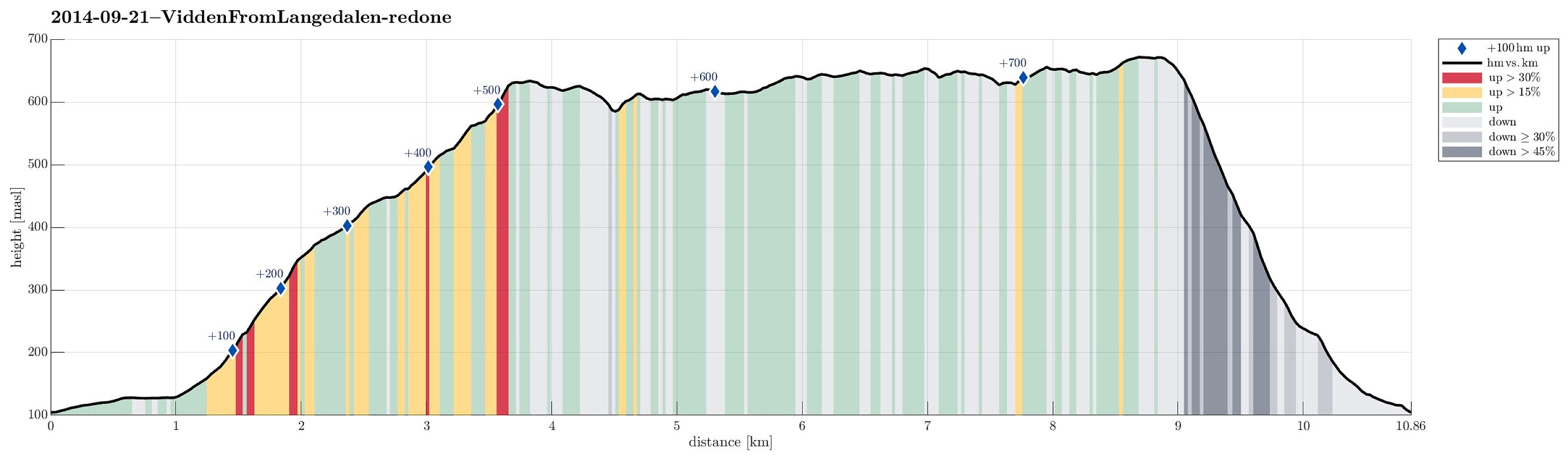
| Tourlänge | 3h 30min |
| Entfernung | 10,9km |
| Höhenmeter | 756m |
| GPS |
|
| Besteigungen | Byfjellenes høyeste punkt (674m) | 21.09.2014 |
|---|---|---|
| Hauggjelsvarden (673m) | 21.09.2014 | |
| Vardegga (637m) | 21.09.2014 | |
| Besuche anderer PBE | Alfjellet (630m) | 21.09.2014 |
| Borgasetra (grunnmur) (440m) | 21.09.2014 | |
| Haukelandsstikkene (659m) | 21.09.2014 | |
| Nødkjelke, Borgaskaret (604m) | 21.09.2014 | |
| Turnerhytten (642m) | 21.09.2014 | |
| Valhal (645m) | 21.09.2014 |
Trip Summary
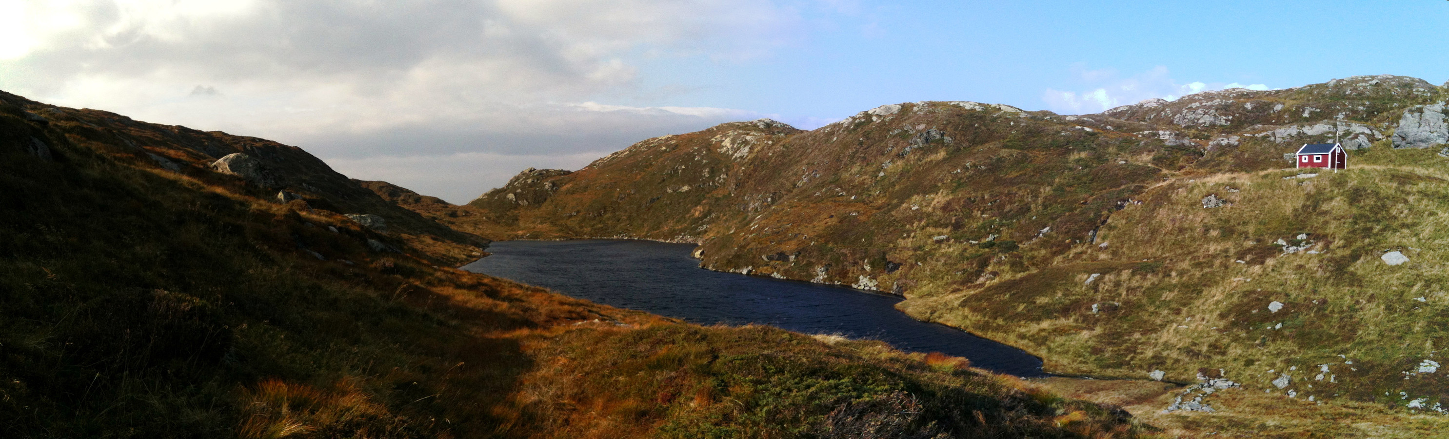
Starting in Langedalen (between Espeland and Rødland), we first followed the road northwards to Borgo, where we left the road to go up to Borgaskaret. We happened to end up on the path up Kvitnosa, which we followed until we reached Borgavatnet. From there, we connected upwards to Vardegga. Going "back" on Vidden, via Borgaskaret and via Storfjellet, we did not really find the shortest path towards Hauggjelsvarden, but went first to Turnerhytten, from where we turned (again) back towards Hauggjelsvarden (via Byfjellenes høyeste punkt). From Hauggjelsvarden, we descended (without a path) to Langedalen (not really a recommended way of getting back).
Useful Resources
Web page WestCoastPeaks.com provides useful information about Haugavarden, Ulriken, Storfjellet, and Landåsfjellet
and also Petter Bjørstad has a useful page about Ulriken.

Benutzerkommentare