Archiv - Nach Datum
Archiv - Nach Aktivität
-
Andere Wintertour (2)
- Schneeschuhtour (2)
-
Fußtour (147)
- Bergtour (67)
- Jogging (2)
- Spaziergang (23)
- Wanderung (55)

Gesammelte Listen
-
Tromsø ≥ 100m pf.
(28/211)
 13%
13% -
Troms ≥ 1000m pf.
(3/36)
8%
-
Munros
(6/283)
2%

Corrán Tuathail
- Datum:
- 14.08.2018
- Tourcharakter:
- Bergtour
- Tourlänge:
- 10:50h
- Entfernung:
- 21,3km
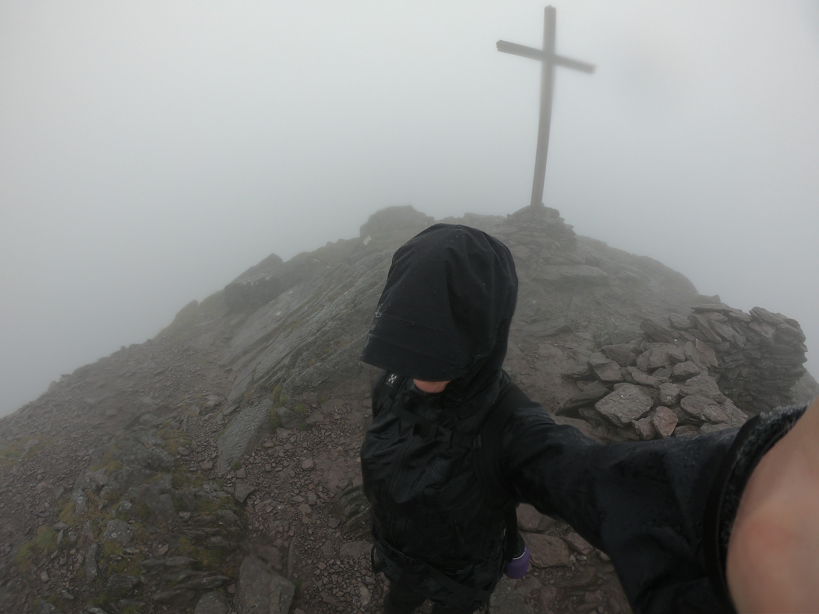 I had originally planned to go the Com Callí [Hag's glen] circle from Cronin's Yard, but as the bus service only go as far as Kate Kearney's Cottage, I decided to start the tour there and go to Cruach Mhór via Cnoc an Bhraca rather than through the glen. Starting out from Kate Kearney's Cottage I headed south towards the Gap of Dunloe and turned right/west onto the gravel road up towards Strickeen Hill. Reaching the plateau there were a few fences blocking the way so I went up the wee Strickeen Hill to get a better view of the path towards Cnoc an Bhraca. It turned out that there is a path along a straight fence almost all the way up to the top, altough some parts of the path were very wet. Ascending up to Cnoc an Bhraca the fog grew thicker and it was time to get out the shell jacket and >>>
Sceilig Mhichíl monastery
- Datum:
- 13.08.2018
- Tourcharakter:
- Wanderung
- Tourlänge:
- 2:30h
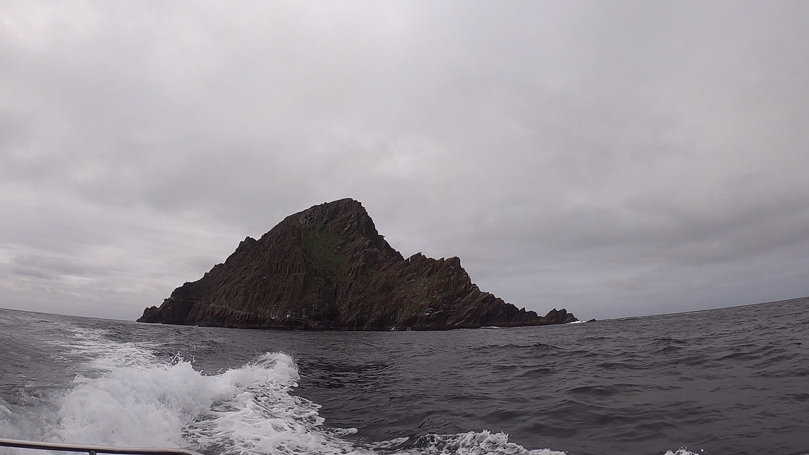 This was a super exciting day! It is hard to come by tickets to a landing boat tour to Sceilig Mhichíl, and even then the trips can be cancelled in the morning due to bad weather. So I was really happy to get a chance to visit this beautiful island with it's extensive bird life, dramatic scenery, rich history of celtic monks building steep stone stairs and a monastary 200 meters above sea level, as well as being the filming location of Ahch-To in the Star Wars VII & VIII films.
The trip started by getting on the Lady Clare in Portmagee and journeying the 12 km out into the Atlantic. First passing the Sceilig Bheag (lit. "Small Rock", known in English as Small Skellig) with its huge bird colonies, and then reaching the Sceilig Mhichíl (lit. "Michael's Rock", referring >>>
This was a super exciting day! It is hard to come by tickets to a landing boat tour to Sceilig Mhichíl, and even then the trips can be cancelled in the morning due to bad weather. So I was really happy to get a chance to visit this beautiful island with it's extensive bird life, dramatic scenery, rich history of celtic monks building steep stone stairs and a monastary 200 meters above sea level, as well as being the filming location of Ahch-To in the Star Wars VII & VIII films.
The trip started by getting on the Lady Clare in Portmagee and journeying the 12 km out into the Atlantic. First passing the Sceilig Bheag (lit. "Small Rock", known in English as Small Skellig) with its huge bird colonies, and then reaching the Sceilig Mhichíl (lit. "Michael's Rock", referring >>>
An Sliabh Corcra
- Datum:
- 11.08.2018
- Tourcharakter:
- Bergtour
- Entfernung:
- 14,9km
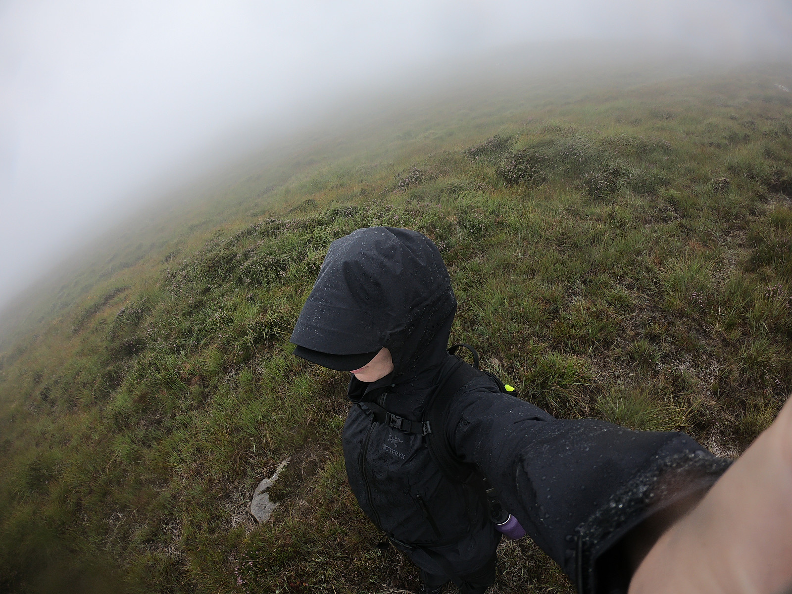 Took the Shuttlebus from Cill Airne (Killarney) to Kate Kearney's Cottage, at the north end of the Gap of Dunloe. Went a wee bit north on the paved road and made a right turn onto a gravel road. Stopped to pet two cosy dogs before I continued on the road until I found a fence. Turned 90 degrees towards the mountains and walked along the fence on a small path. After a while the path disappeared and I set off in the general direction of Tomies Mountain. The ascent through the grass became successively steeper. Anything that resembled a path seemed set to mislead me in a direction away from my intended goals for the day. The light fog around the tops became thicker and a sudden onset of rain caught me off guard, and accompanied me for the rest of the tour.
Relying on fog obscured sight and an occasional >>>
Took the Shuttlebus from Cill Airne (Killarney) to Kate Kearney's Cottage, at the north end of the Gap of Dunloe. Went a wee bit north on the paved road and made a right turn onto a gravel road. Stopped to pet two cosy dogs before I continued on the road until I found a fence. Turned 90 degrees towards the mountains and walked along the fence on a small path. After a while the path disappeared and I set off in the general direction of Tomies Mountain. The ascent through the grass became successively steeper. Anything that resembled a path seemed set to mislead me in a direction away from my intended goals for the day. The light fog around the tops became thicker and a sudden onset of rain caught me off guard, and accompanied me for the rest of the tour.
Relying on fog obscured sight and an occasional >>>
Torc Mountain
- Datum:
- 09.08.2018
- Tourcharakter:
- Bergtour
- Tourlänge:
- 4:07h
- Entfernung:
- 18,9km
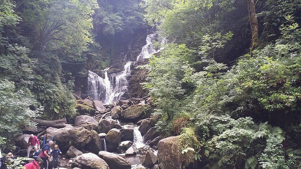 Took the shuttle bus from Cill Airne (Killarney) to Torc Waterfall car park. Started walking along the blue trail towards and past Torc Waterfall to the upper car park. Left the blue trail at a T intersection and followed the path of the Kerry Way up until the sign indicating the ascent to Torc Mountain. The path up to the top was mostly made up of wooden planks and stone steps. Nice view of Cill Airne on the other side of Muckross Lake and Lough Leane. Took a break to eat and drink.
Took the same way down until I reached the T intersection close to the upper car park. This time I followed the blue path along the other part of the loop back to the lower car park. As I realised that the next bus to Cill Airne would not depart for over an hour, I started walking the path along Muckross Lake and >>>
Took the shuttle bus from Cill Airne (Killarney) to Torc Waterfall car park. Started walking along the blue trail towards and past Torc Waterfall to the upper car park. Left the blue trail at a T intersection and followed the path of the Kerry Way up until the sign indicating the ascent to Torc Mountain. The path up to the top was mostly made up of wooden planks and stone steps. Nice view of Cill Airne on the other side of Muckross Lake and Lough Leane. Took a break to eat and drink.
Took the same way down until I reached the T intersection close to the upper car park. This time I followed the blue path along the other part of the loop back to the lower car park. As I realised that the next bus to Cill Airne would not depart for over an hour, I started walking the path along Muckross Lake and >>>

