Arkiv - dato
Arkiv - aktivitet

Lister jeg samler etter
-
Tromsø ≥ 100m pf.
(28/211)
 13%
13% -
Troms ≥ 1000m pf.
(3/36)
8%
-
Munros
(6/283)
2%

Ben Lomond
- Dato:
- 14.06.2012
- Turtype:
- Fjelltur
- Turlengde:
- 5:13t
- Distanse:
- 13,8km
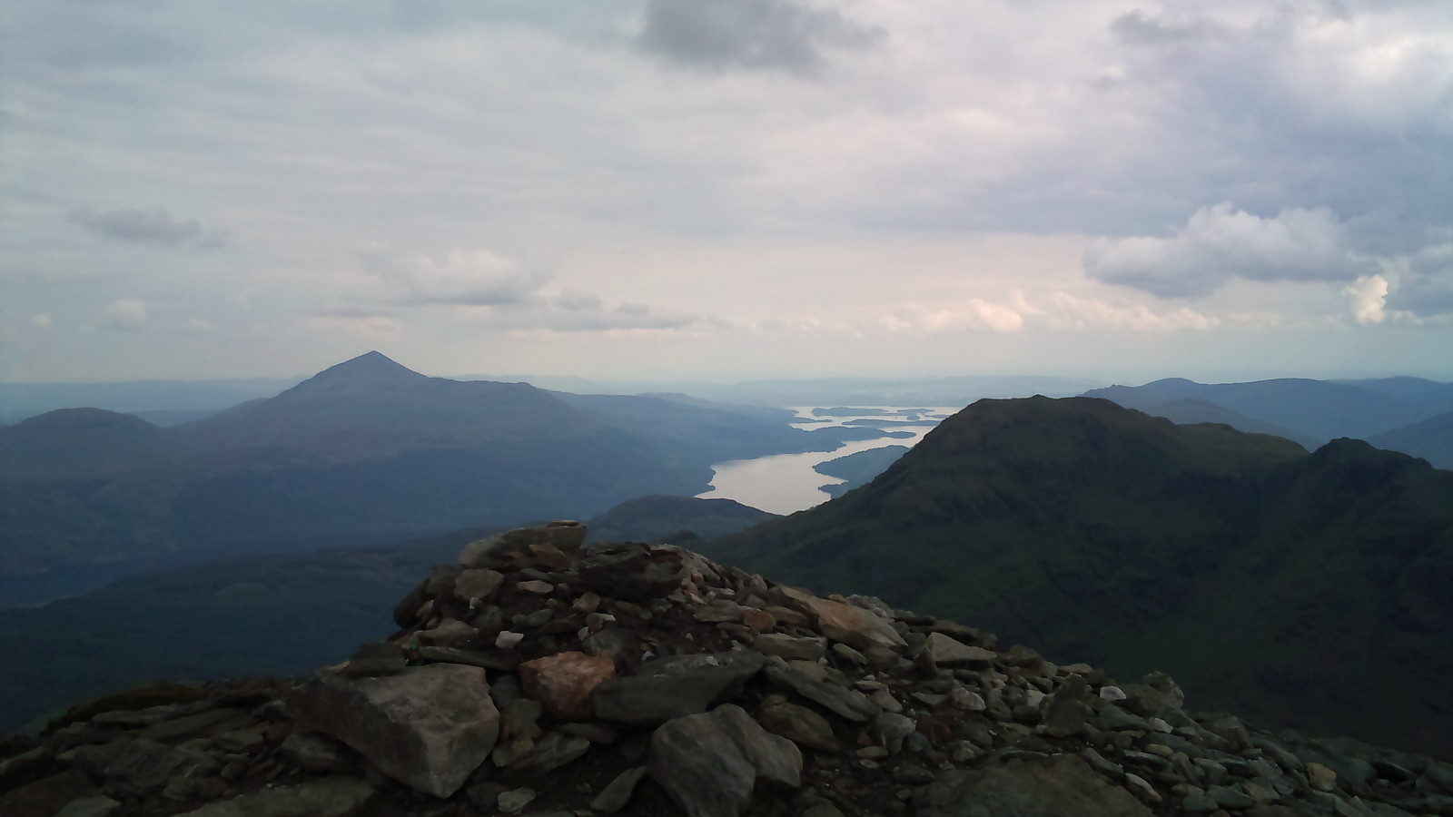
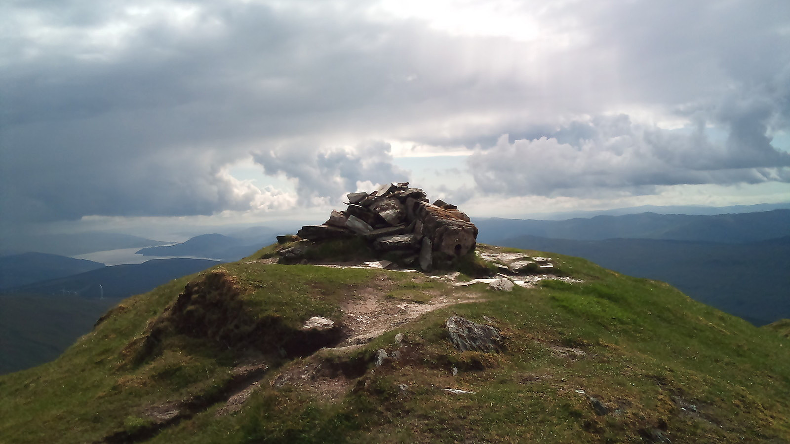
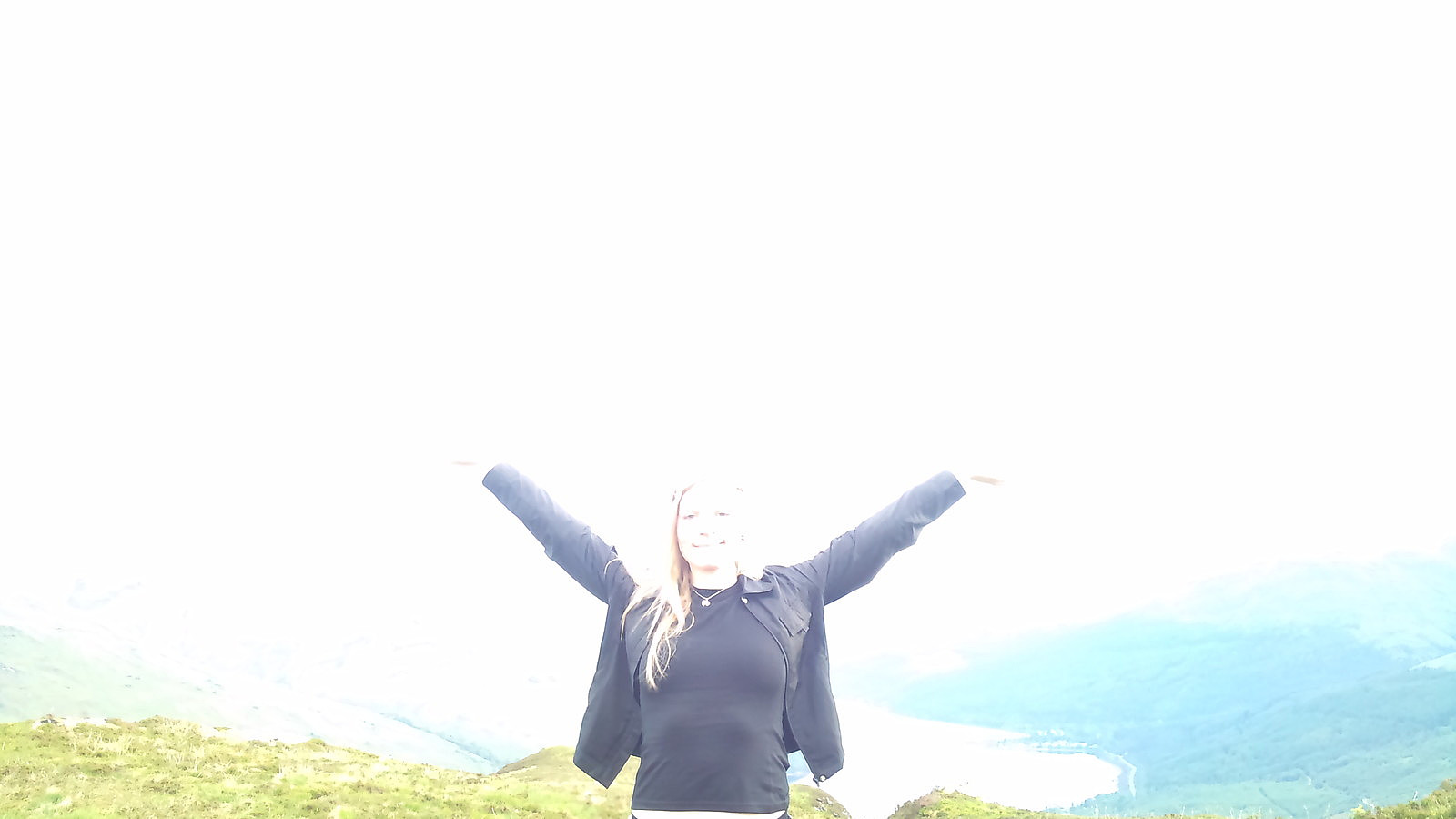
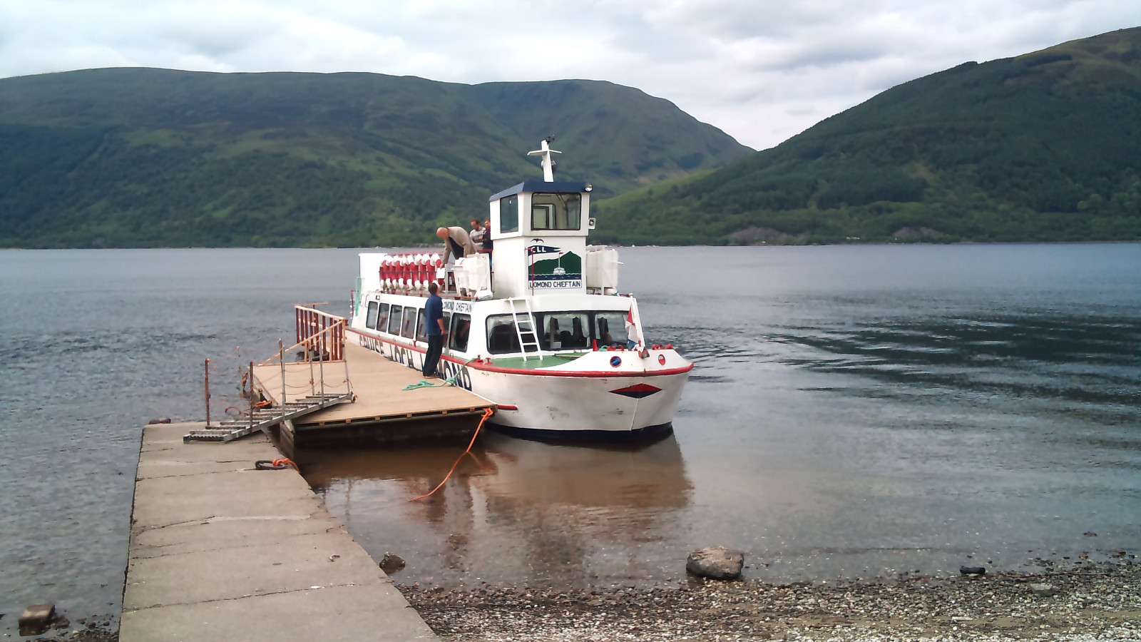 The last Munro to ascend on my trip to Arrochar was Ben Lomond. With good weather and safely knowing I would reach all six Munros in the area I walked from Arrochar to Tarbert from where the ferry crosses Loch Lomond to Rowardennan. A very nice boat trip with only two other passengers. I couldn't stop myself from quietly singing the folk song Loch Lomond, wishing I had my bagpipe or tin whistle with me for the ride :)
Arriving in Rowardennan I set out for a well walked path up the ben. I wouldn't take a wheelchair up, but it was the most well maintained foot path I'd set foot on this week. And there was so many people! If I had met no more than three or four people on the previous mountains, here I walked by over 20 just on my way up, and actually had to stay in line to get a shot of the ward >>>
The last Munro to ascend on my trip to Arrochar was Ben Lomond. With good weather and safely knowing I would reach all six Munros in the area I walked from Arrochar to Tarbert from where the ferry crosses Loch Lomond to Rowardennan. A very nice boat trip with only two other passengers. I couldn't stop myself from quietly singing the folk song Loch Lomond, wishing I had my bagpipe or tin whistle with me for the ride :)
Arriving in Rowardennan I set out for a well walked path up the ben. I wouldn't take a wheelchair up, but it was the most well maintained foot path I'd set foot on this week. And there was so many people! If I had met no more than three or four people on the previous mountains, here I walked by over 20 just on my way up, and actually had to stay in line to get a shot of the ward >>>
Ben Arthur & Beinn Narnain
- Dato:
- 10.06.2012
- Turtype:
- Fjelltur
- Turlengde:
- 5:06t
- Distanse:
- 15,9km
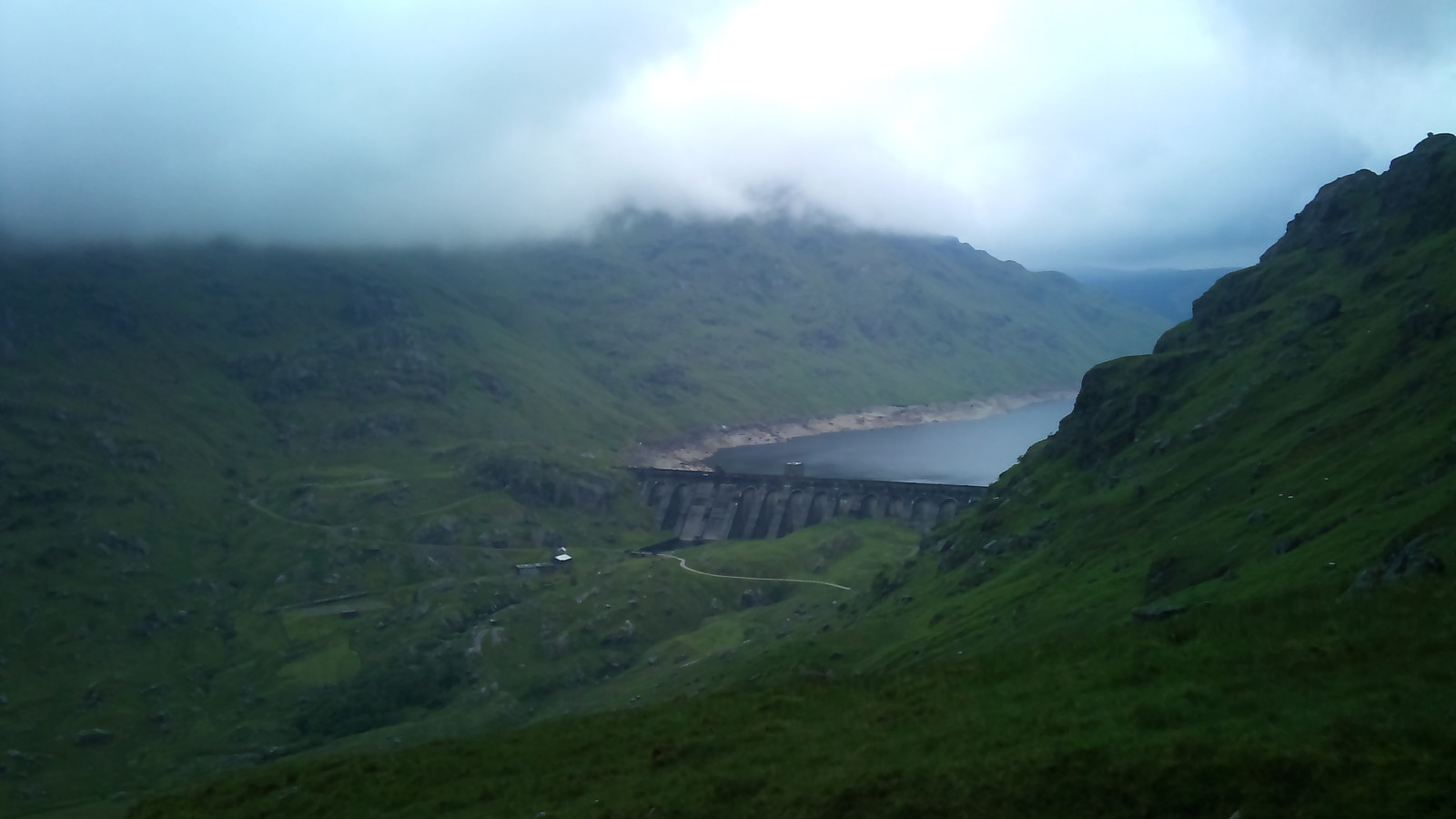
 Started out from the hotell in Arrochar heading for the munro mountains of Beinn Narnain and Beinn Ìme. After a short walk from the village of Arrochar there is a good footh path up the mountain pass between Ben Arthur and Beinn Narnain, gaining some hundreds of meters in height before approaching the routes to the mountain tops themselves. While I even spotted a few rays from the sun when starting out, the weather steadily went on to light rain and fog. Happily I found a natural shelter under a huge boulder along the road where I could stop and eat some snacks before moving on.
Ben Arthur, or The Cobbler, is one of those popular mountains everyone talks about, so I thought it might be worth getting up there, the top being so close to Beinn Narnain. After a bit of walking and light scrambling >>>
Started out from the hotell in Arrochar heading for the munro mountains of Beinn Narnain and Beinn Ìme. After a short walk from the village of Arrochar there is a good footh path up the mountain pass between Ben Arthur and Beinn Narnain, gaining some hundreds of meters in height before approaching the routes to the mountain tops themselves. While I even spotted a few rays from the sun when starting out, the weather steadily went on to light rain and fog. Happily I found a natural shelter under a huge boulder along the road where I could stop and eat some snacks before moving on.
Ben Arthur, or The Cobbler, is one of those popular mountains everyone talks about, so I thought it might be worth getting up there, the top being so close to Beinn Narnain. After a bit of walking and light scrambling >>>
Beinn Bhuidhe
- Dato:
- 09.06.2012
- Turtype:
- Fjelltur
- Turlengde:
- 7:35t
- Distanse:
- 22,4km
 My very first Munro mountain, so exciting!
. I took the bus to Cairdow/Loch Fyne Oyster Bar and walked the paved road in to Glen Fyne, which after a while turns into a path, til I reached the landmark of an old cottage. There was supposed to be a path up the ben at the cottage, but I couldn't find it so I just walked straight up the mountain heading for the top. It was very steep and included jumping over a sheep fence at one point. Almost at the top, of course I found the path leading there. So, hey, a path, that'll make the descent much easier, right? Well, a path that is in many parts very dilapidated might not be so easy after all and it required quite a bit of scrambling to get down, so I'm very glad I took the steep sheep way up the ben after all! In the end I returned safely down the mountain >>>
My very first Munro mountain, so exciting!
. I took the bus to Cairdow/Loch Fyne Oyster Bar and walked the paved road in to Glen Fyne, which after a while turns into a path, til I reached the landmark of an old cottage. There was supposed to be a path up the ben at the cottage, but I couldn't find it so I just walked straight up the mountain heading for the top. It was very steep and included jumping over a sheep fence at one point. Almost at the top, of course I found the path leading there. So, hey, a path, that'll make the descent much easier, right? Well, a path that is in many parts very dilapidated might not be so easy after all and it required quite a bit of scrambling to get down, so I'm very glad I took the steep sheep way up the ben after all! In the end I returned safely down the mountain >>>
Cruach Tairbeirt
- Dato:
- 08.06.2012
- Turtype:
- Fjelltur
- Turlengde:
- 1:46t
- Distanse:
- 7,6km
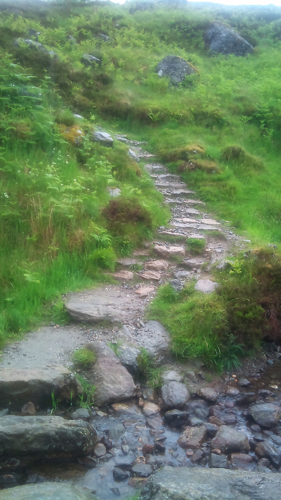
 Short walk up little Cruach Tairbeirt after arrival to the hotel in Arrochar, my first actual top in Scotland.
Walked by the A83 car road from Arrochar to the Arrochar/Tarbert train station and then went uphill via path that suddenly disappeared, continued walking under the big trees and some grassy plains to reach the top. Despite being quite a small mountain just over 400 meters over sea level, it offers a very nice view over Loch Lomond and the surrounding hills. At the top I found a good walking path down, slightly to the east of my ascent which led back to the train station from where I also found a path through the woods back to Arrochar.
Short walk up little Cruach Tairbeirt after arrival to the hotel in Arrochar, my first actual top in Scotland.
Walked by the A83 car road from Arrochar to the Arrochar/Tarbert train station and then went uphill via path that suddenly disappeared, continued walking under the big trees and some grassy plains to reach the top. Despite being quite a small mountain just over 400 meters over sea level, it offers a very nice view over Loch Lomond and the surrounding hills. At the top I found a good walking path down, slightly to the east of my ascent which led back to the train station from where I also found a path through the woods back to Arrochar.

