
Piz Bernina - Biancograt (28.06.2021)

Written by hmsv1 (Hannah Vickers)

| Start point | Pontresina (2,591m) |
|---|---|
| Endpoint | Diavolezza (3,577m) |
| Characteristic | Alpine trip |
| Duration | 8h 10min |
| Distance | 13.0km |
| Vertical meters | 1,728m |
| GPS |
|
| Ascents | Piz Bernina (4,049m) | 28.06.2021 |
|---|
After a week spent in Zermatt doing various acclimatization hikes, I relocated to the Chemin des Etoiles, a chalet in Evolene which has been (and probably will continue to be!) my annual summer holiday base for the last five years. Anyway, it was great to be back in familiar surroundings again, though the chalet was pretty quiet this week with only 4 of us staying there. I’d been keeping an eye on the weather forecast for several 4000m-peaks I had on my wishlist for this summer, but it looked like the best weather would be further east in Switzerland for the start of this week. I’d not been up Piz Bernina, and the Biancograt was one of the routes I’d wanted to do for a number of years, so it seemed like a good option to start with. Did a quick check with Graham, the guide who I’d be climbing with and he thought it was a good idea too so we rang up the Tschierva hut to book spaces there for the Sunday night and enquire about conditions on the route. Apparently it was very good, which was promising to hear.
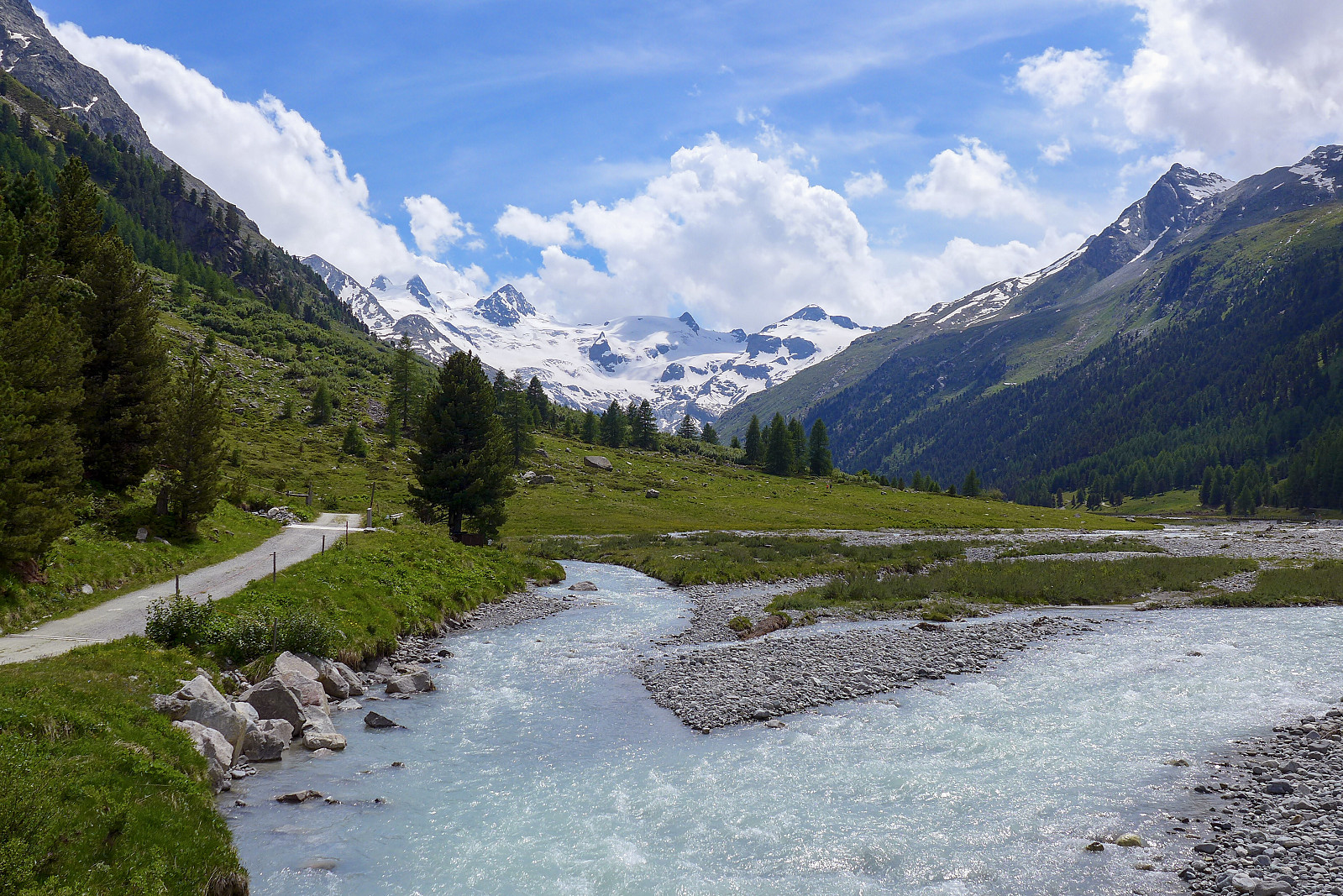
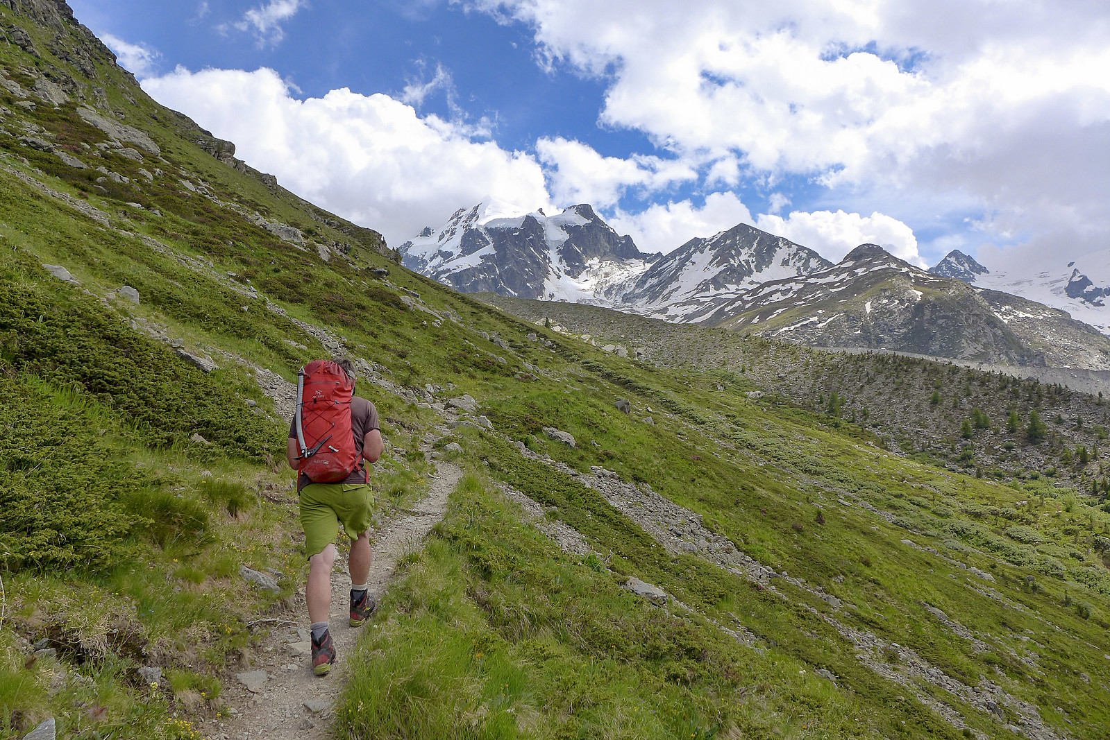
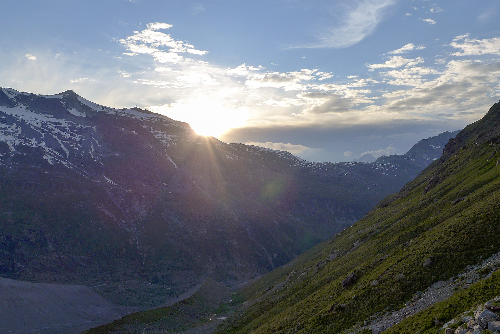
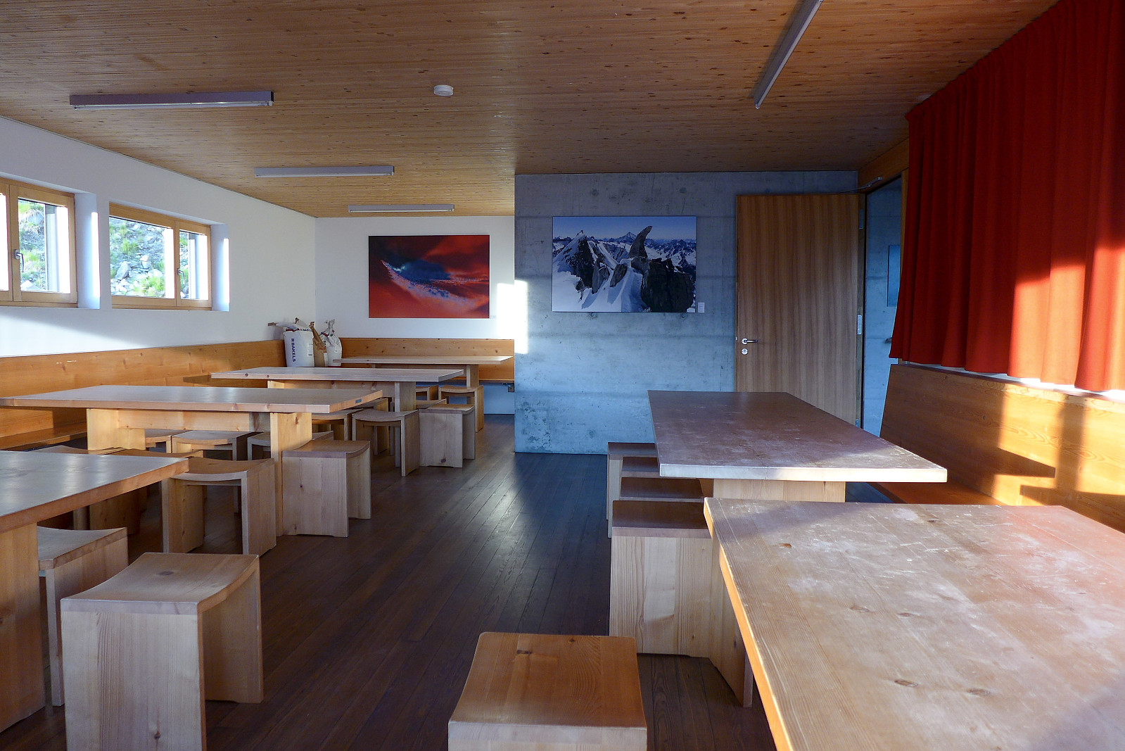
It was a loooooong drive from Evolene to Pontresina, the starting point for the walk up to the Tschierva hut. We left at around 7.30am and began the drive eastwards, with a brief stop at the Furka pass to use the toilets and have a drink before continuing along the (mostly) winding roads to the Oberalp pass and Albula pass, then finally descending down toward Samedan and Pontresina after about 6 hours of travelling. I’m sure it would have been a quiet scenic and nice long drive, had I not started feeling car sick on the way down from the Furka pass, only some 2 hours into the journey...! We parked at the train station car park in Pontresina (can be paid for with the Easypark app) and started the long walk southwards in the Val Roseg. It was expected to be around 3.5-4 hours to the Tschierva hut, so we‘d probably get there just in time for dinner at 6.30pm. It was actually a nice walk-in, beginning with a relatively flat 5-6 km along the river to reach Roseg then the path gradually began to ascend the lower western slopes of Piz Tschierva, winding its way southeastwards after the treeline. As we turned the corner, the western side of the Biancograt came into view, although from this angle the steepness of the ridge never became fully apparent. Fortunately it never got baking hot as I’d feared, and we had some pleasant cloud cover for most of the walk-in. Despite a modest 700m height gain to the hut it was nevertheless around 12.5 km in total distance... after which I realised I’d not spent enough time getting used to carrying a heavy-ish rucksack in the past few months. My shoulders definitely felt used by the time we arrived at the hut! There were already a number of people around, so it was by no means quiet - but at the same time not crammed with people either. It was a pretty nice hut with a fairly modern interior and we shared a dormitory with only two other people, so hopefully it wouldn’t be too noisy in the night. After dinner I gave the Marco e Rosa hut (on the southern side of Piz Bernina) a call to see if they had spaces for the following night. Graham had suggested to traverse Piz Palu on the way back to Diavolezza instead of descending via the Fortezza ridge, but I reckoned that even if the weather wasn’t good enough to bother with Piz Palu it would at least be beneficial to sleep up there (the Marco e Rosa hut is at 3600 m) for extra acclimatization.
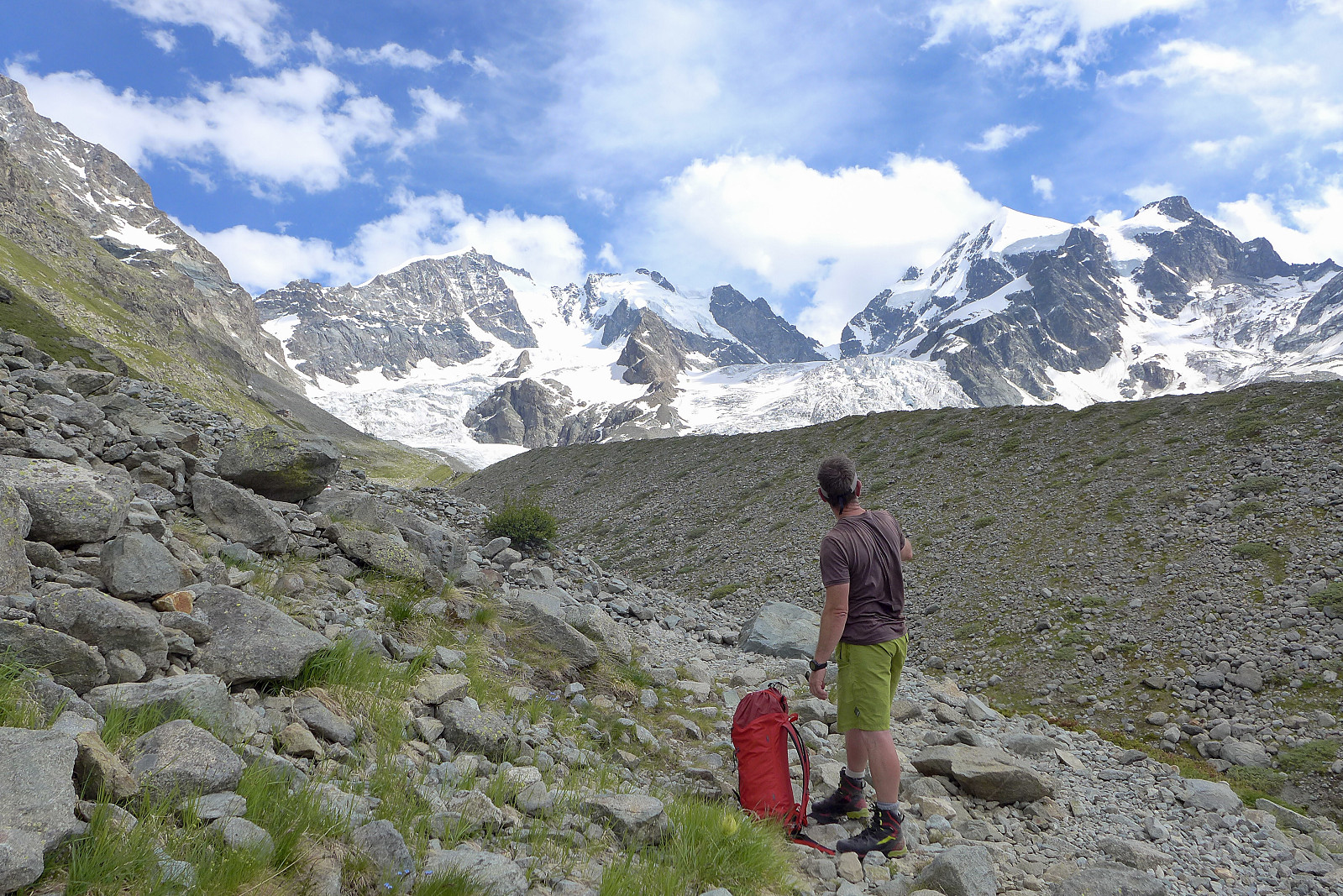
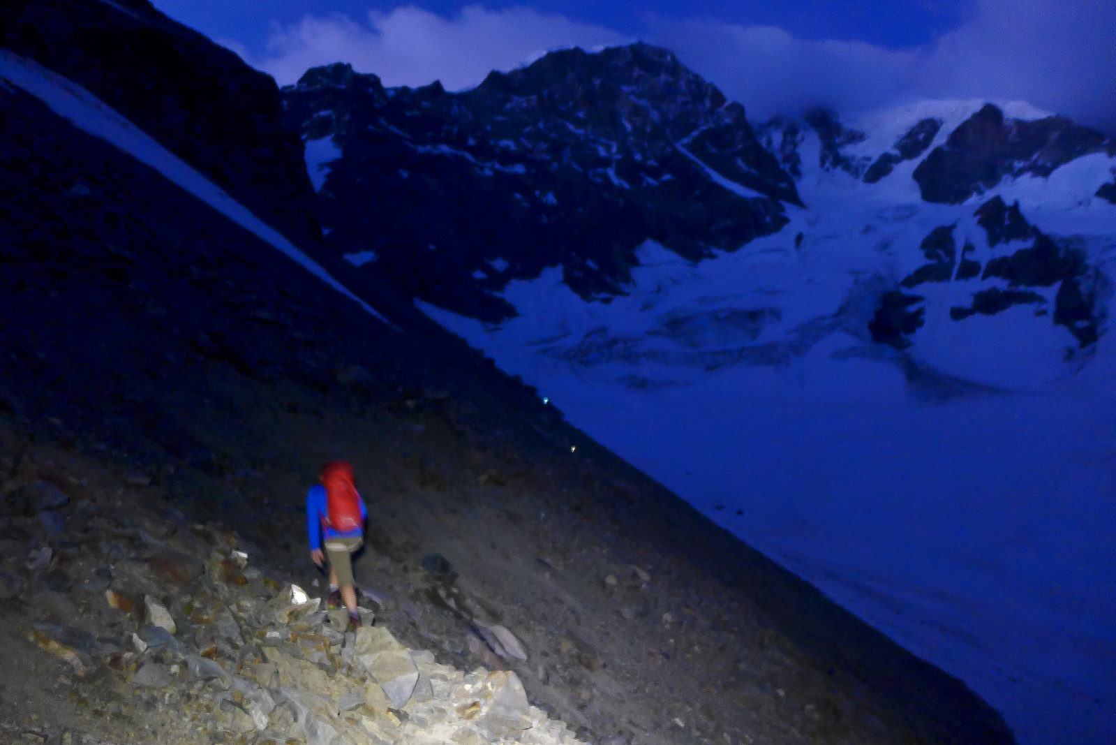
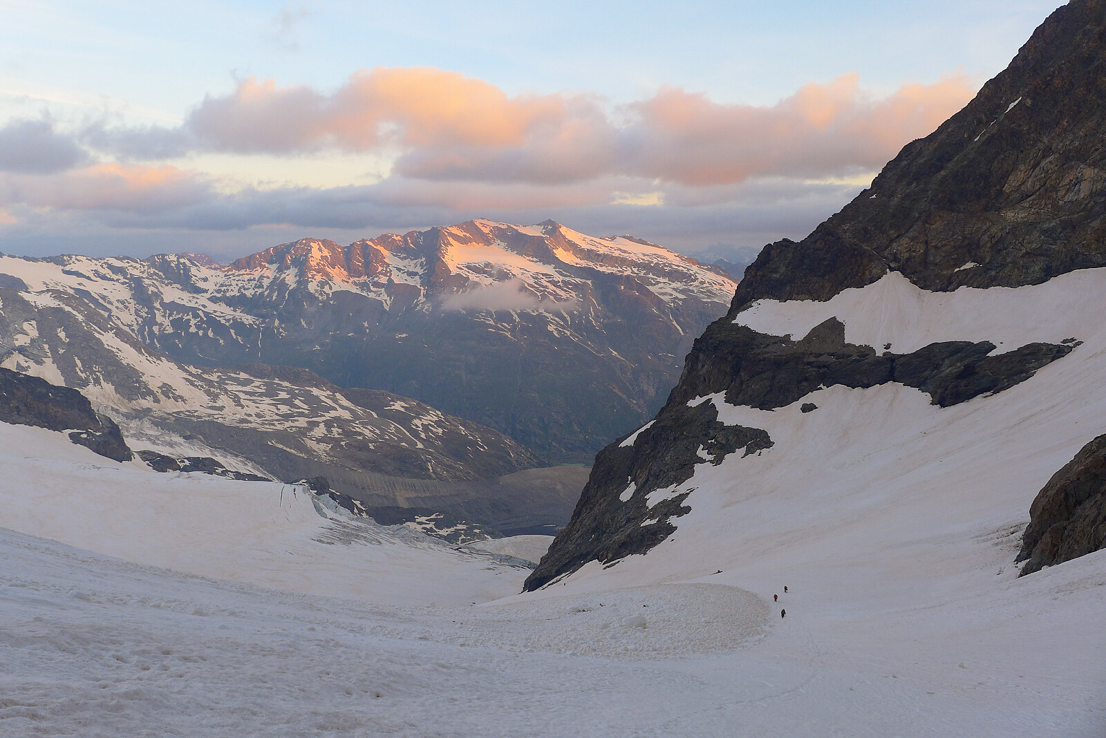
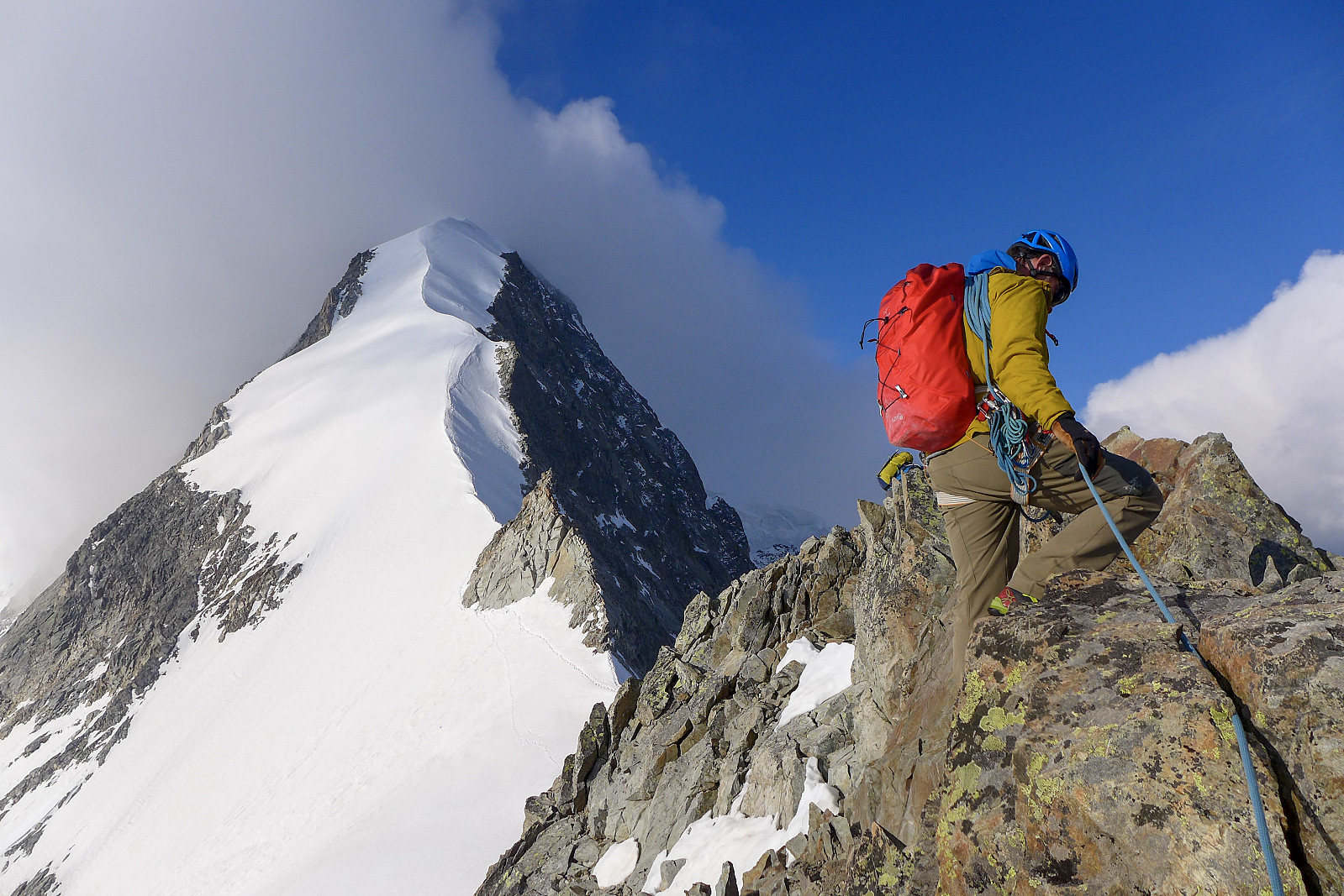
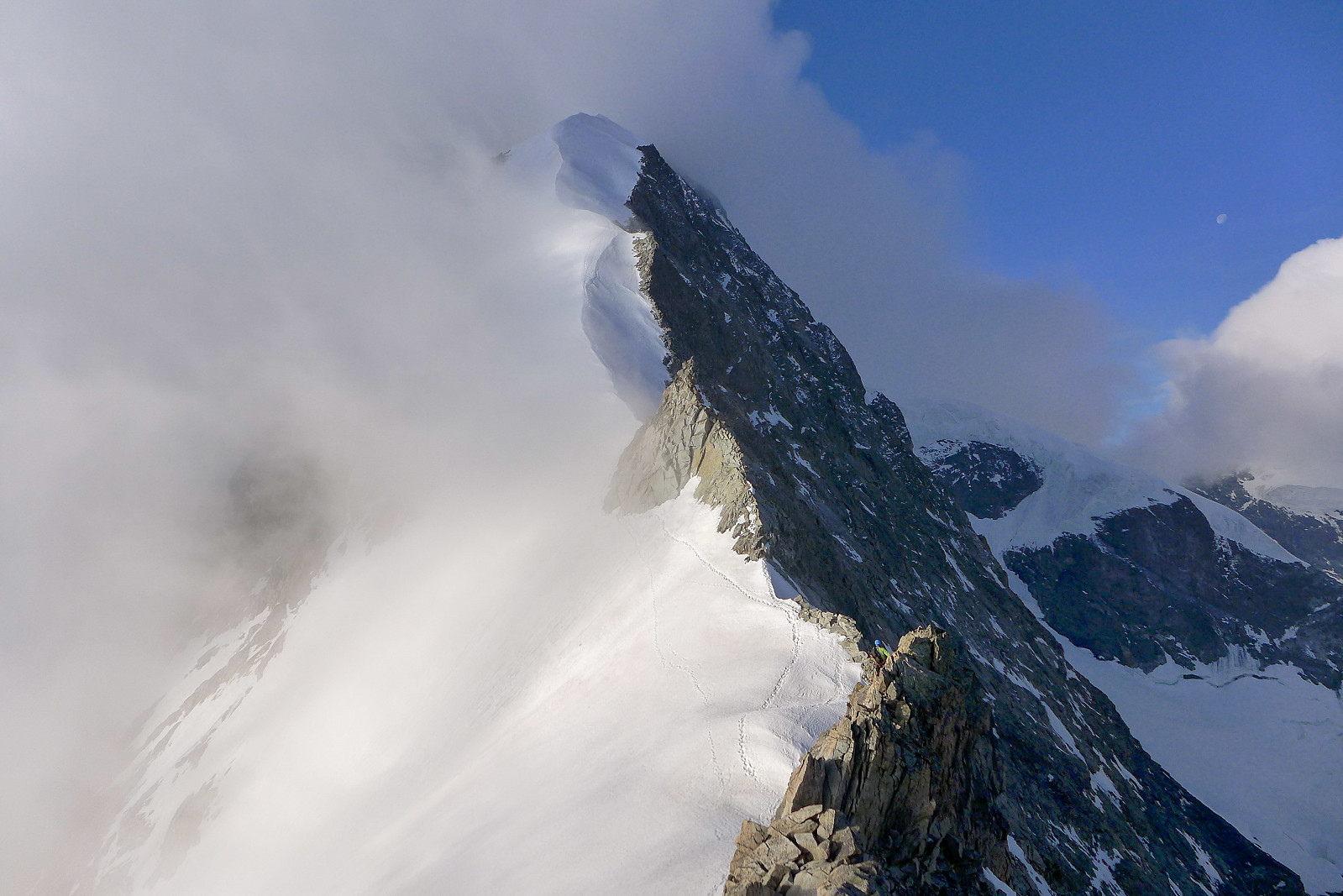
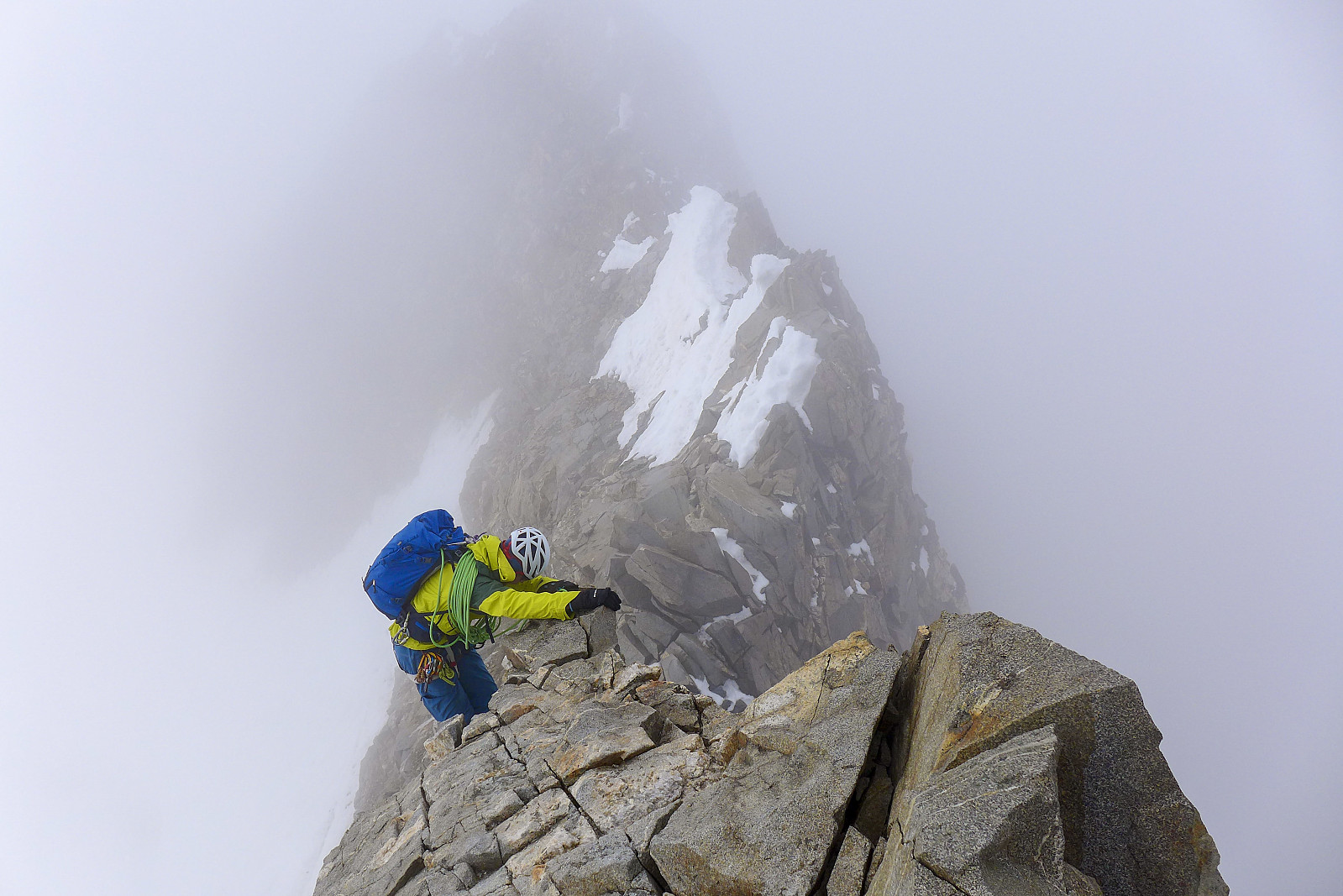
There was never going to be a risk of sleeping past breakfast time the next morning - as usual there were always a handful of people getting up long before 3am anyway, and they were easily heard walking past the dormitories. After a breakfast of some coffee, bread and cheese we got geared up for the approach walk to the Fuorcla Prievlusa, which is essentially a saddle separating Piz Prievlus and Pizzo Bianco, the summit lying at the top of the Biancograt. It was a steep path but at least well trodden and not overly loose. Maybe a bit loose in some places but otherwise well marked and easy to walk on, even in a pair of Scarpa Phantom Techs. It took about an hour(ish) to reach the edge of the glacier, where we roped up and put crampons on. From there it was decent refrozen snow all the way up to the Fuorcla Prievlusa, where we were treated to a nice sunrise and a scattering of thin clouds. A couple of teams were already on the first part of the route, an easy rock ridge leading to the foot of the Biancograt but we didn’t really need to wait to start climbing since it was a bit windy and we had to put on a couple of jackets, so by the time we’d finished that the teams had already moved on. The rock was really nice to scramble on – pretty solid and dry. There was actually more time on the rock than I was expecting but it was a pleasant surprise. It also offered a great head-on view of the Biancograt! An easy downclimb took us to the start of the snow and we took a quick break here before moving onwards and upwards. Unfortunately it looked like the chances of a cloud-free summit were rapidly decreasing, but I held out hope that the morning clouds might just disintegrate by the time we got close to the top.
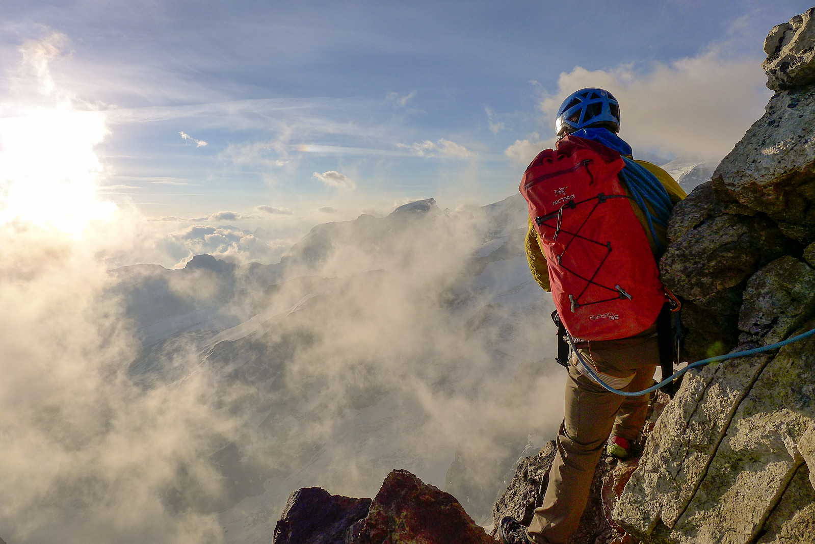
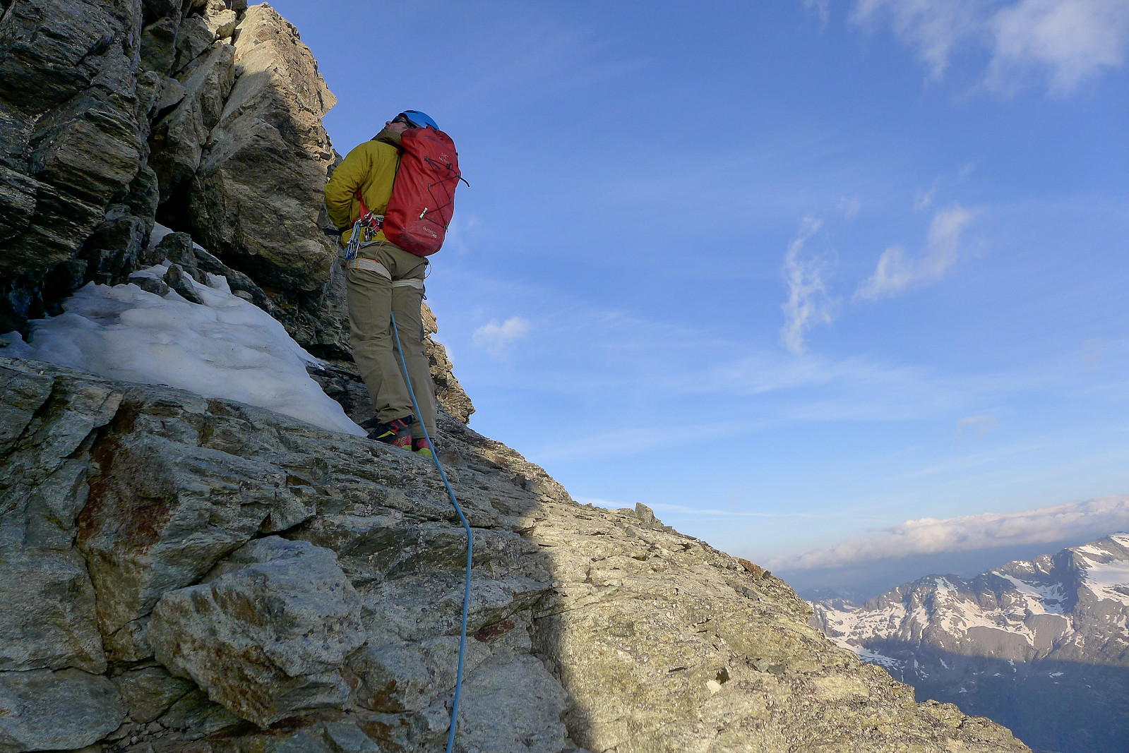
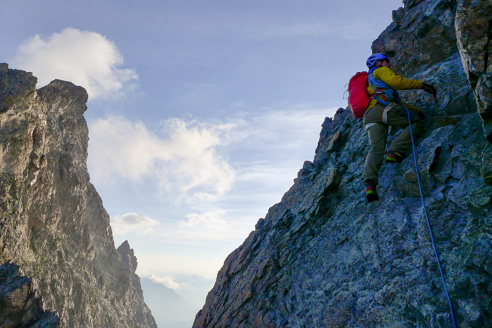
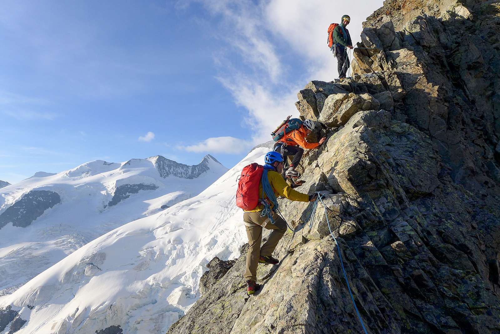
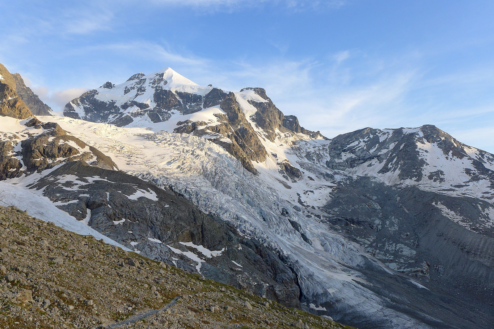
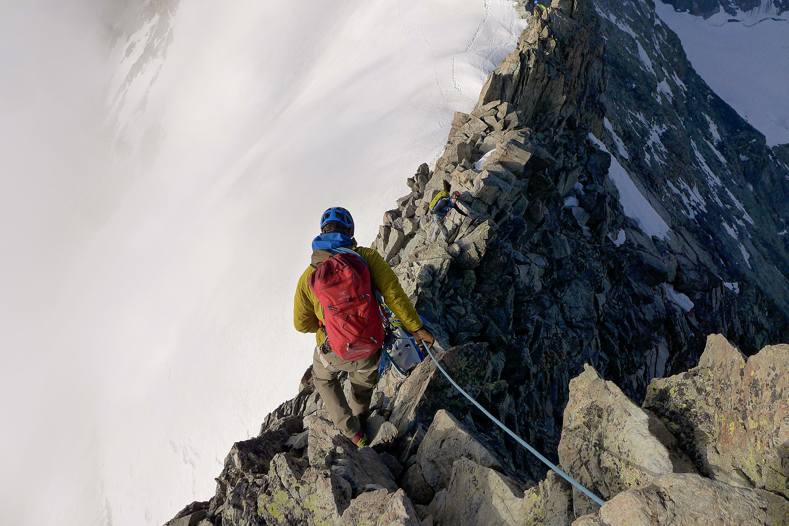
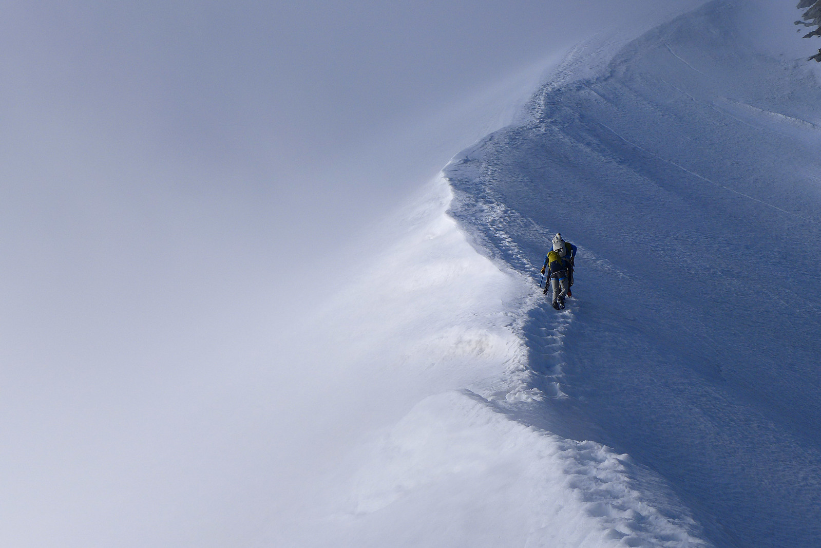
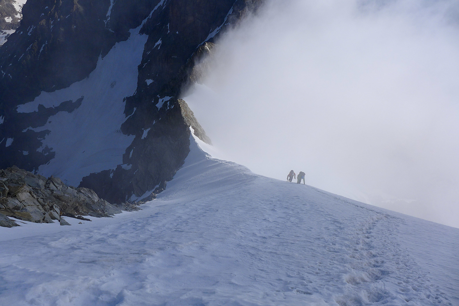
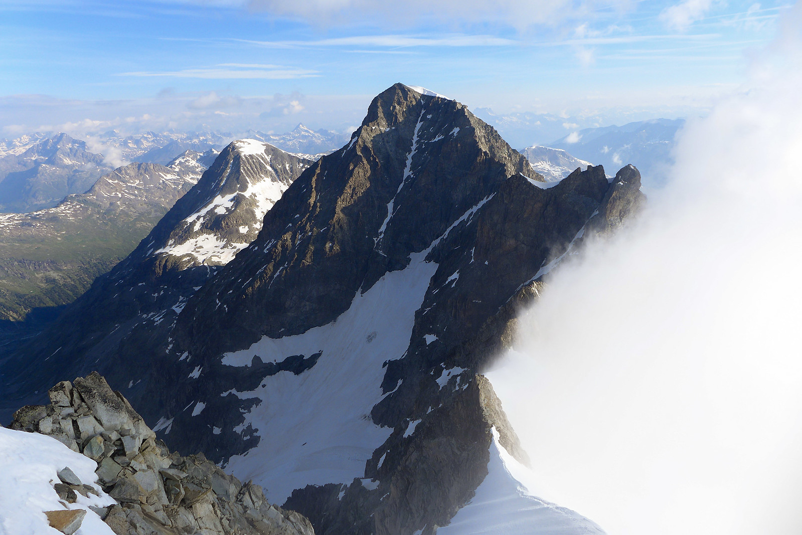
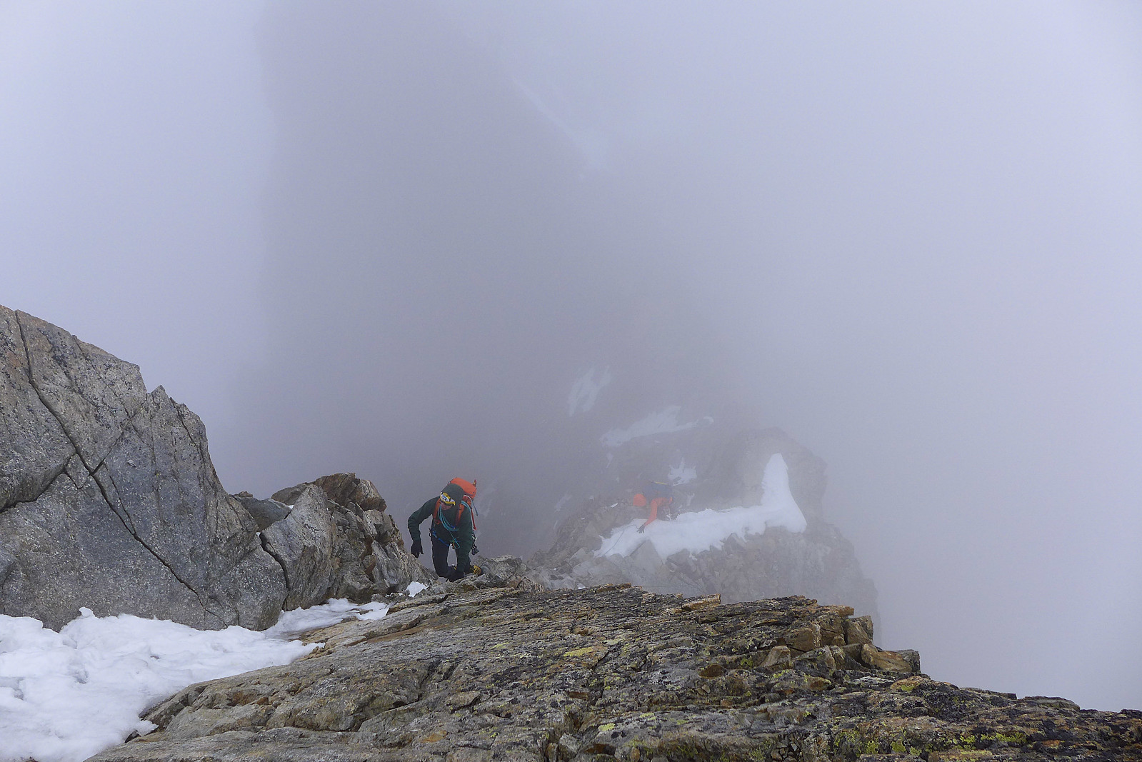
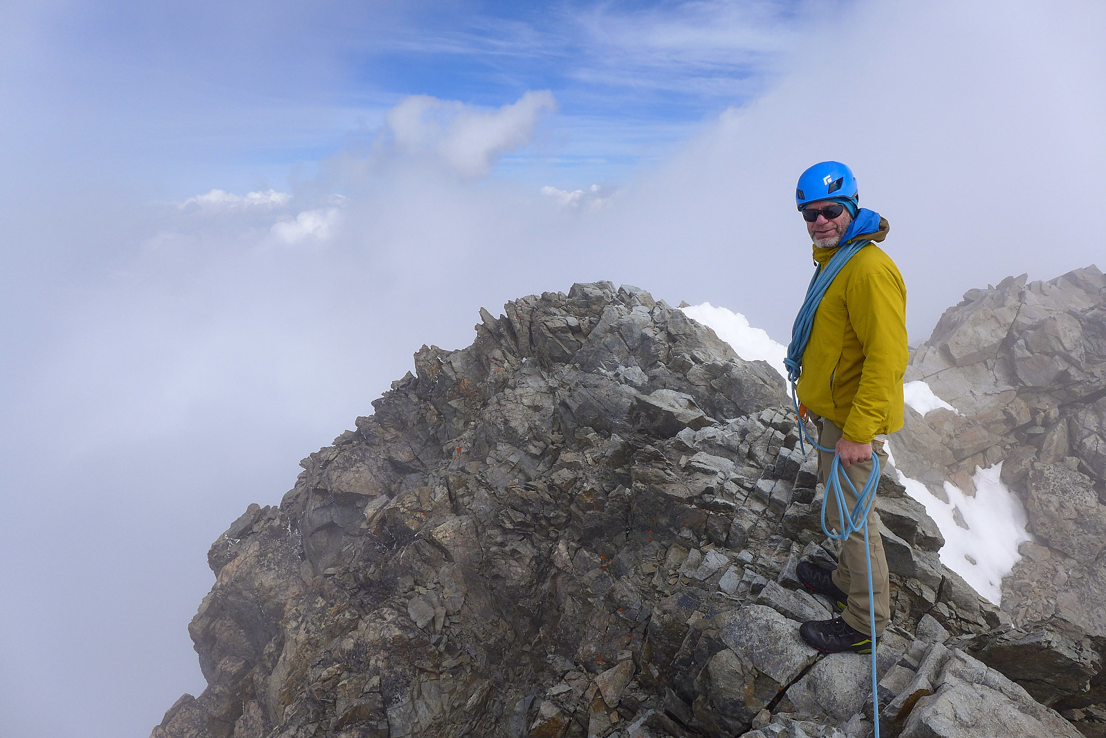
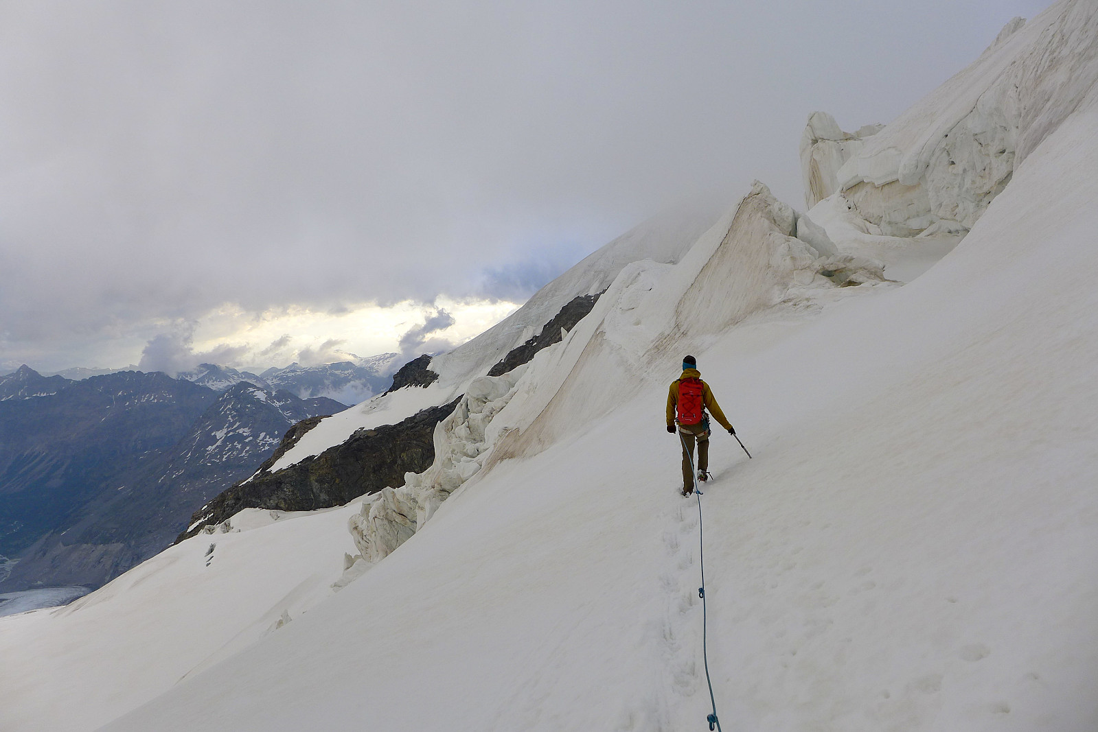
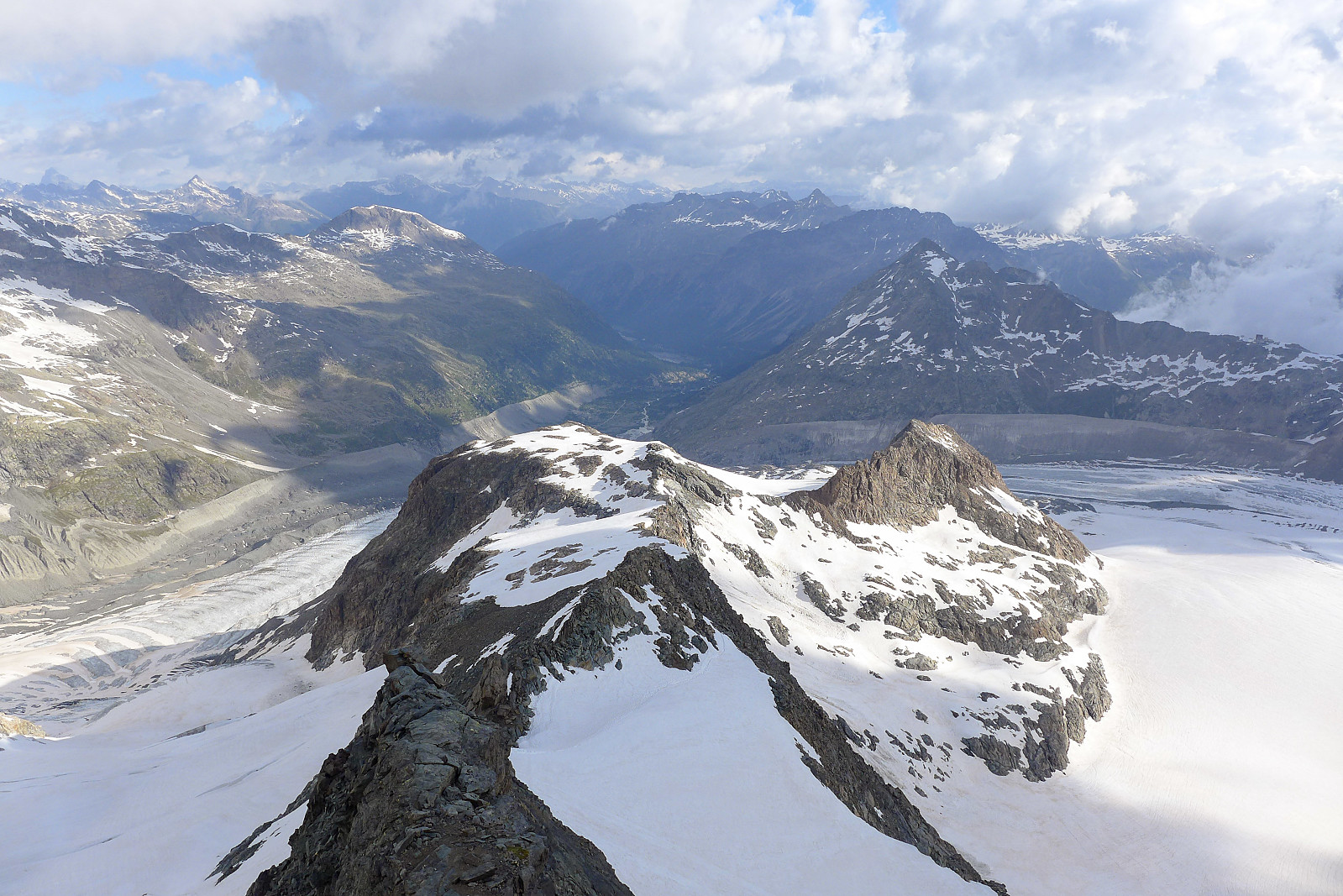
The Biancograt itself was basically a never ending steep snow (and in some places ice) ridge. For the most part there was a decent track and we moved together but there were one or two short sections of maybe 50 degrees, which were also icy so Graham put in a few ice screws along the way. I was actually feeling most tired on this part of the route. The rock had been easy and fun, but slogging up the snow without a view was a bit uninspiring. I was pretty glad when we finally reached the top of the Pizzo Bianco and the end of the snow! From here we took off crampons and continued along the rock ridge to the summit of the Piz Bernina. It seemed like most parties were not as swift moving on rock as they were on snow... and there was a bit of queuing along the ridge especially where some downclimbing was involved, which slowed progress down a bit. But once we’d overtaken them all things progressed a bit faster :-) Just as we approached the summit there was a very brief glimpse of the sun breaking through the cloud, which filled me with a new sense of positivity. It turned out to be a very shortlived episode with sunshine though and by the time we’d reached the summit the fog was back again and all views had disappeared. Nevertheless, it was a good feeling to be at the top and know that there was only a short descent to reach to the Marco e Rosa hut. We stopped and chatted with another couple on the summit for about 10 or 15 minutes before giving up on waiting for the sun and any kind of view, then began the descent which basically followed the ridge over La Spedla (another summit) before some more down climbing followed and we were down on the snow again. Despite being only about 200 m in elevation to descend on the glacier down to the Marco e Rosa hut it felt like an eternity wading through crap snow. There seemed to be surprise holes everywhere and the snow was so mushy the easiest part of the descent was unfortunately the least fun part of the day. We were pretty glad to not be continuing the descent in these conditions for another 9 km to Diavolezza!
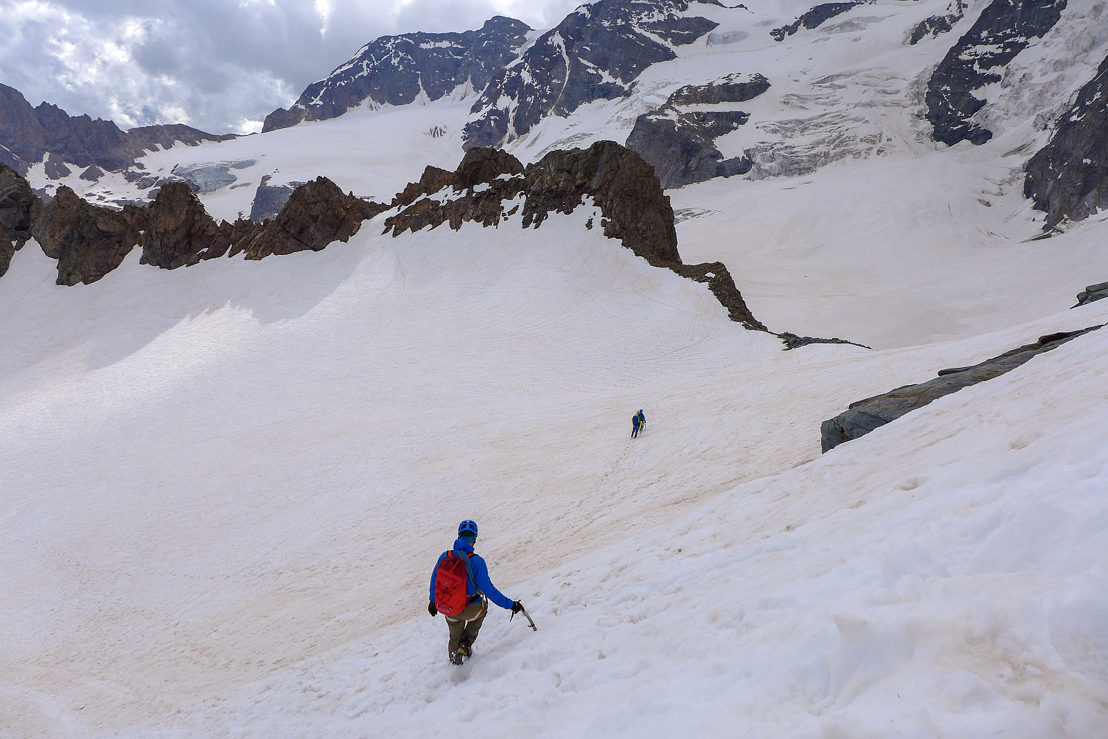
It was a long afternoon at the Marco e Rosa hut spent drinking lots, eating pasta for lunch and taking an afternoon nap to pass the time until dinner. We shared a table with two Swiss dudes, one of them a guide (quite a good looking one too) from Andermatt, which was nice company. Most people went to bed fairly early and it was a relatively quiet night in the dormitory, though I didn’t really get much sleep. Next morning we woke up to rain and a lot of wind outside the hut, which was not exactly inspiring for a traverse of Piz Palu, so we took a pretty late and relaxed breakfast (biscuits) at 5am in the hope that the rain would have stopped by the time we were ready to leave. I think we were last out of the hut at 6.30am, but at least we didn’t leave in the rain! The descent to Diavolezza started with a somewhat dull trudge across the Morteratsch glacier towards Bellavista in the fog, and my legs were feeling pretty tired. Either they had been carb-deprived or sleep deprived, I don’t know which. Anyway, it was a relief to finally reach the spur leading down to the Fortezza ridge and get off the snow for a while. There was a bit of queuing though... we’d caught up most of the teams who’d left an hour before us, and it was near-impossible to pass any of them here. Fortunately some of them weren’t too bothered about waiting around and quite happily let us past. Once past the first bottleneck we progressed pretty quickly along the ridge, with easy scrambling and downclimbing the parts where others were setting up abseils. Once we were finished with the rock it was a matter of trudging down more crap snow to reach the Pers glacier, which we had to cross to reach the moraine path going up to Diavolezza on the other side. Fortunately the snow on the glacier was less crap than the snow on the descent down to it!
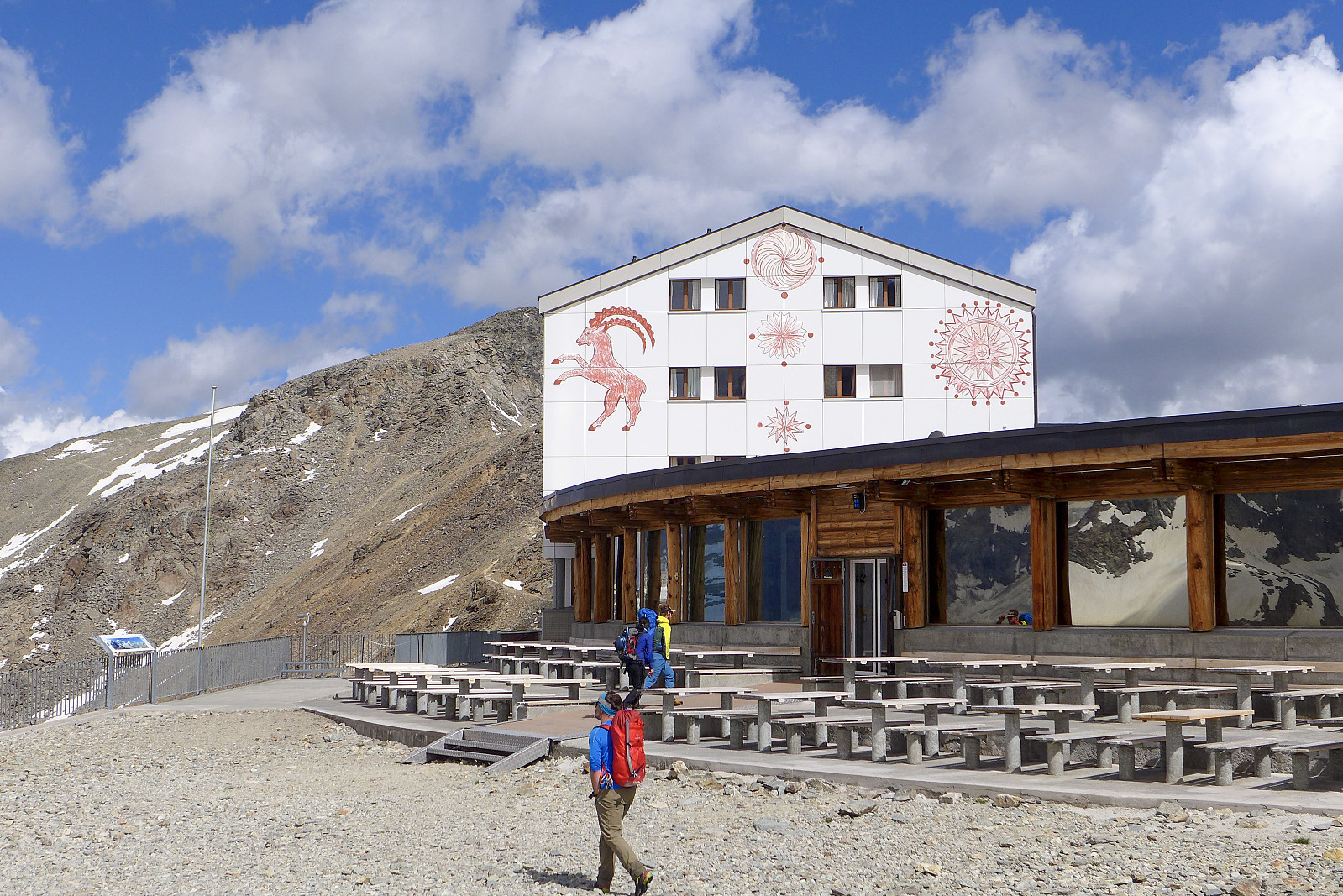
I was half expecting to be feeling super tired on the walk back up from the glacier to Diavolezza, but it turned out that my legs had now woken up and were more than ready for some uphill walking again. Even though the clouds hadn’t really lifted from the highest summits surrounding the Pers glacier, it was still a great view to enjoy for the last half hour or so before we finally reached the hotel and gondola at Diavolezza. After a short encounter with a frustrated gondola operator/ticket man we were soon on the rapid 1000m descent down to the valley, where we caught the train going westwards towards Pontresina. All in all a really good start... and hopefully the only 4000m without a view from the summit this year :-)

| Start date | 28.06.2021 03:32 (UTC+01:00 DST) |
| End date | 28.06.2021 11:42 (UTC+01:00 DST) |
| Total Time | 8h 10min |
| Moving Time | 7h 50min |
| Stopped Time | 0h 19min |
| Overall Average | 1.6km/h |
| Moving Average | 1.7km/h |
| Distance | 13.0km |
| Vertical meters | 1,728m |


User comments