Archive - Date
Archive - Activity
-
Climbing (43)
- Alpine climbing (31)
- Ice climbing (3)
- Mixed climbing (1)
- Sport climbing (3)
- Via ferrata (1)
-
Other trip (5)
- Expedition (5)
-
Other winter trip (5)
- Snowshoe trip (5)
-
Ski trip (449)
- Backcountry skiing (4)
- Cross-country skiing (2)
- Randonnée/Telemark (441)
-
Trip by foot (507)
- Alpine trip (47)
- Hike (196)
- Hillwalk (205)
- Jogging (4)
- Walk (55)
Peakbook-Friends


Skadet på Sydalsfjellet
- Date:
- 23.03.2013
- Characteristic:
- Randonnée/Telemark
- Distance:
- 7.0km
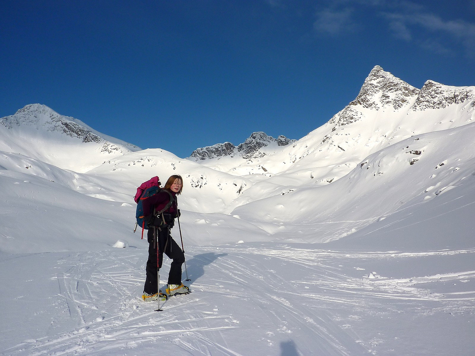
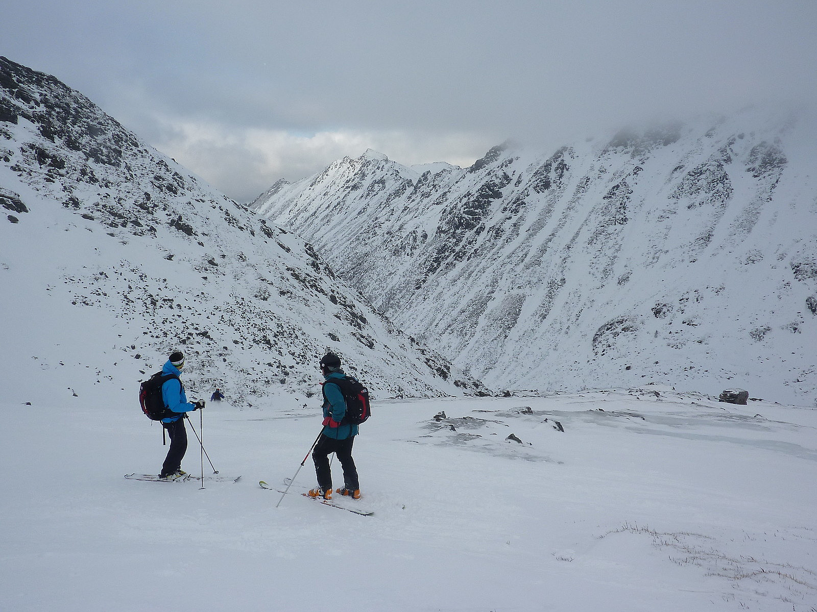 After having had a short trip on our first day in Lofoten, Aline and I were super-enthusiastic to have a longer ski trip. Sydalsfjellet turned out to be the only ‘full’ topptur option, since the other trips which were being run on the Saturday were either skogskjøring or ski/surf combination. Fortunately both of us managed to get a place on the Sydalsfjellet trip before the sign-up list had filled up. Unfortunately the weather didn’t look all that promising in the beginning of the day when we met up with our guides Marius and Bjørn at 9am at the Henningsvær Bryggehotell. Altogether there were 13 participants on the trip, so it was a relatively large group. Null visibility and light snow was not at all inspirational, but we clambered on board the minibus anyway with a dash of hope that >>>
Stampen
- Date:
- 22.03.2013
- Characteristic:
- Backcountry skiing
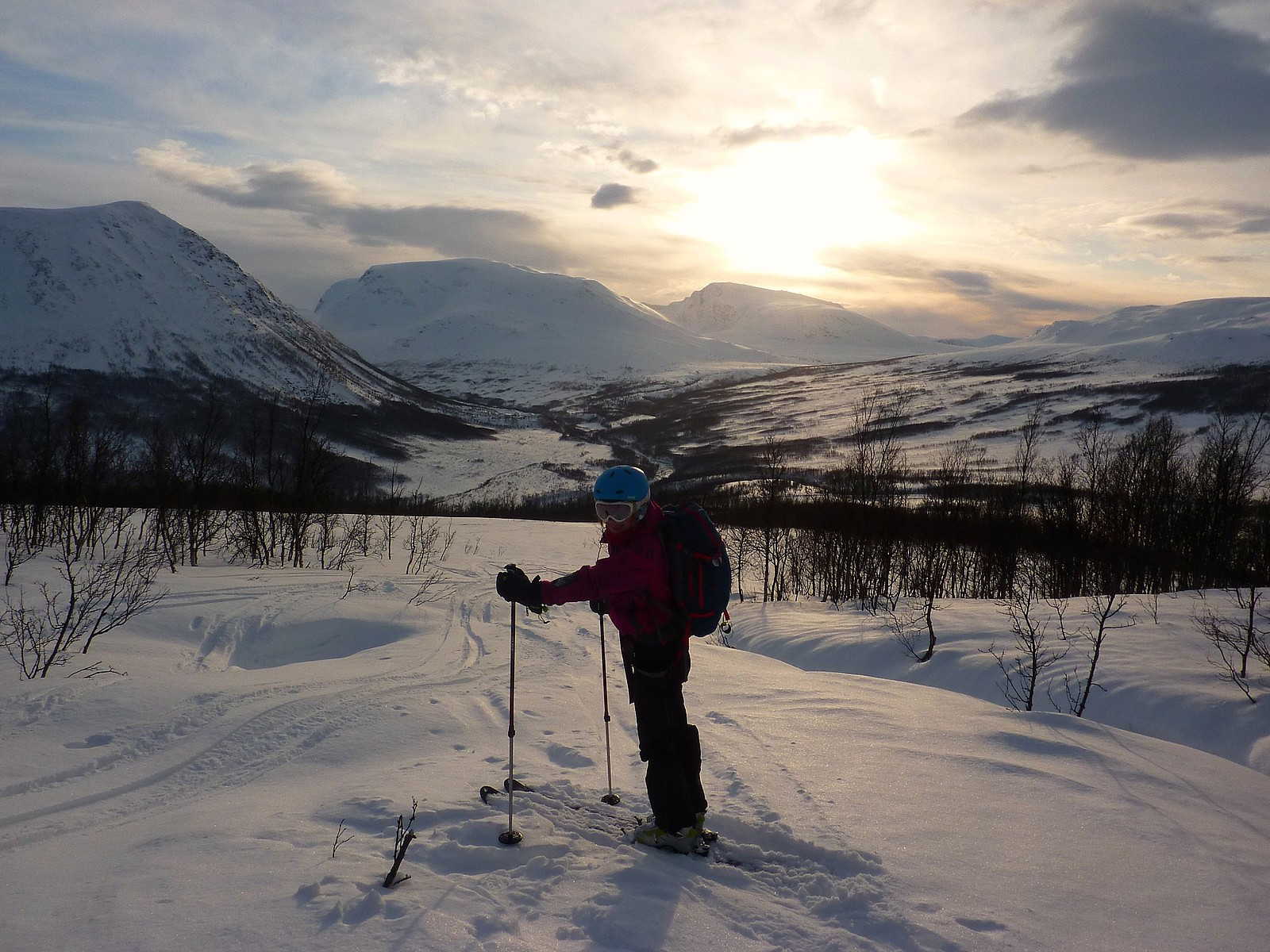
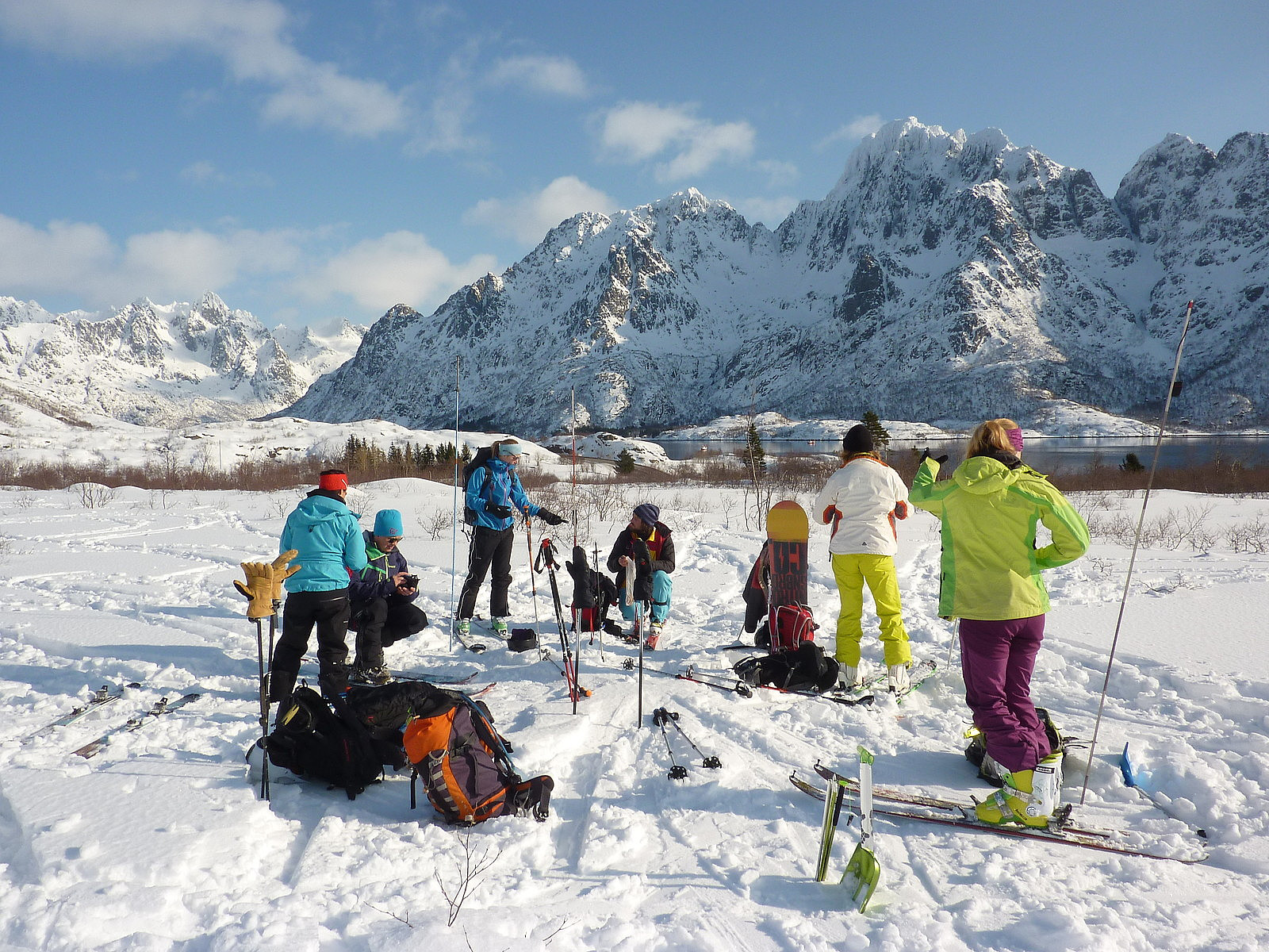 My first trip of Camp Lofoten with Aline and Siv. We'd expected to be taking a trip to Sautinden, but as things happened we ended up on Stampen instead. The meet-up with the ret of our group and the guides was at 9.00 by the Henningsvær Bryggehotell and the drive to the starting point for the ascent was a scenic 40-minute drive down the E10. And we couldn't have asked for a better welcome with the blue skies and sunshine we got, even if the forecast did hint that it wouldn't be staying like this for very long! The group was around 9 or 10 including our guide Sverre, and we used the first hour or so using the avalanche transceivers in search mode. For us and perhaps one or two others in the group, the practice wasn't new but served as good revision on what we had already learnt on the skredkurs >>>
Breitinden (Ringvassøya)
- Date:
- 20.03.2013
- Characteristic:
- Randonnée/Telemark
- Distance:
- 14.0km
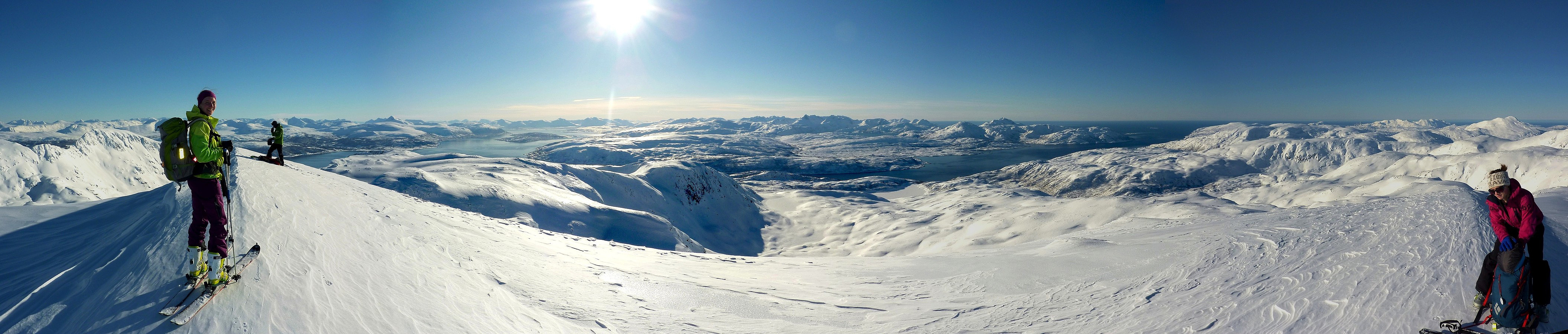 I dag ble det en jentetur til Breitinden på Ringvassøya med både Kristin og Aline. Det var flott å ha Aline med på tur igjen, spesielt fordi det hadde blitt nesten to måneder siden vår siste tur sammen. Strålende sol, lite vind og et nytt fjell som turmål gjorde at vi følte oss veldig spent på å komme oss ut på tur så fort som mulig. Heldigvis var reisen til utgangspunktet ved Simavika bare en halv time bilkjøring fra Tromsø. Dro relativt tidlig fra Tromsø omtrent kl.9.30, så var det kl.10.15 da vi begynte turen.
Vi visste at turen skulle bli enkel med en jevn, slak stigning nesten hele ruten oppover. Vi valgte å bruke veien som gikk inn i Ytredalen og det var et par kilometer før vi tok av til høyre (sør) siden av dalen og begynte å få spist noen høydemetre gjennom >>>
I dag ble det en jentetur til Breitinden på Ringvassøya med både Kristin og Aline. Det var flott å ha Aline med på tur igjen, spesielt fordi det hadde blitt nesten to måneder siden vår siste tur sammen. Strålende sol, lite vind og et nytt fjell som turmål gjorde at vi følte oss veldig spent på å komme oss ut på tur så fort som mulig. Heldigvis var reisen til utgangspunktet ved Simavika bare en halv time bilkjøring fra Tromsø. Dro relativt tidlig fra Tromsø omtrent kl.9.30, så var det kl.10.15 da vi begynte turen.
Vi visste at turen skulle bli enkel med en jevn, slak stigning nesten hele ruten oppover. Vi valgte å bruke veien som gikk inn i Ytredalen og det var et par kilometer før vi tok av til høyre (sør) siden av dalen og begynte å få spist noen høydemetre gjennom >>>
Nonstindtraversen med FSG
- Date:
- 16.03.2013
- Characteristic:
- Randonnée/Telemark
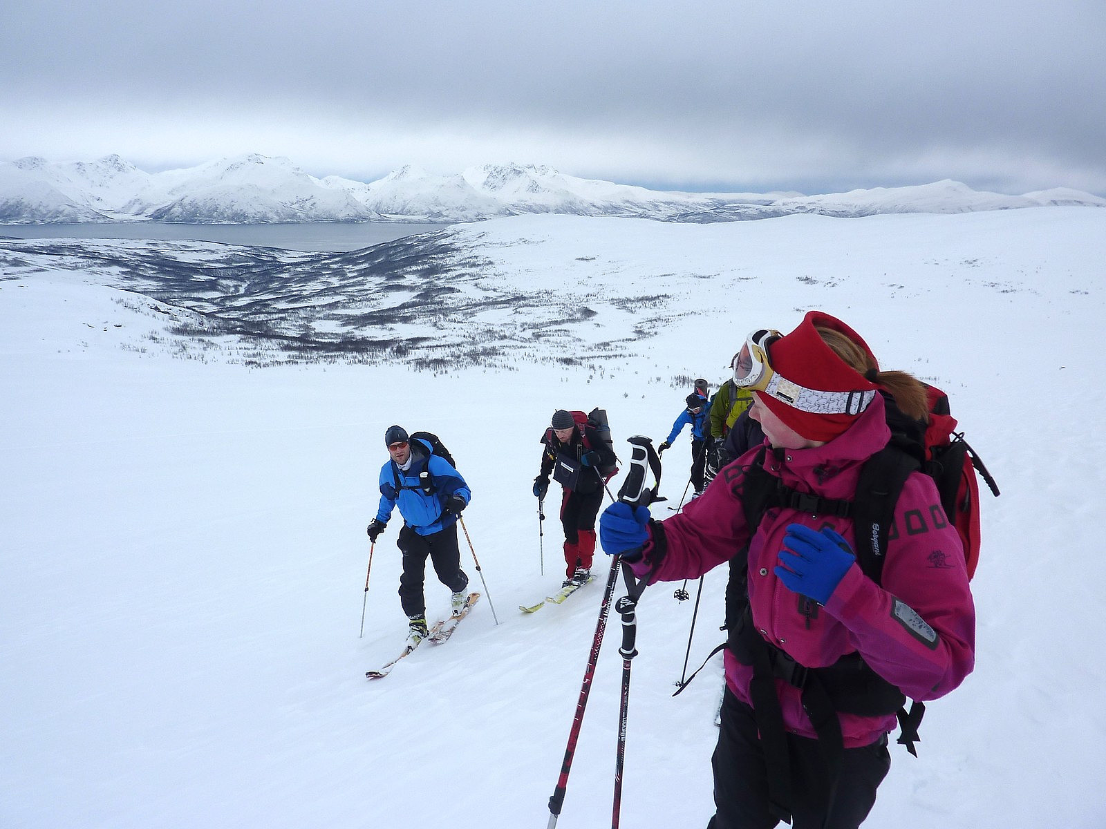 After what had seemed like a long time since my last trip with the fjellsportgruppa, it was finally time for another fellestur. This time the objective was a traverse of Nonstinden. And now that I had built up a little toppturing experience with half a dozen or so ski trips since investing in a pair of randonee skis two months earlier, I was under the (perhaps false) belief that my skiing had graduated to a level of proficiency to potentially keep up with a group of Norwegian ski-masters. While the group actually turned out to be a rather international mixture of Norwegian, Swedish, Polish and British, it turned out that I had overestimated my ability to steer a pair of planks on my feet downhill. Nevertheless, my uphill skiing abilities seem not to present any problem at all, apart from causing >>>
Skitntinden
- Date:
- 03.03.2013
- Characteristic:
- Hike
- Duration:
- 4:30h
- Distance:
- 9.0km
 Skitntinden er antakeligvis en av de mest populære skifjell i nærområdet av Tromsø, eller dette er inntrykk jeg har fått så langt. Da kan du si at det er ikke så vanlig å se turfolk tar med stegjern og isøks istedenfor ski på vinterstid. Kanskje det er noe av en forbrytelse når man besøker et kjent skifjell uten å stå på ski....
Derimot, etter vår tur til Ullstinden dagen før, hadde jeg lite lyst til å kjøre skiene mine på isete snø og selv om vi visste at snøforholdene kan være helt annerledes på andre fjell, bestemte vi oss for å få en ulik type tur i dag. Med tanker på at vi ville få enda mer is på sørsider av fjellene (pga hovedvindretningen de siste par dagene), trodde vi at Skitntinden kunne bli et godt turmål for en fottur. I tillegg hadde Skitntinden vært >>>
Skitntinden er antakeligvis en av de mest populære skifjell i nærområdet av Tromsø, eller dette er inntrykk jeg har fått så langt. Da kan du si at det er ikke så vanlig å se turfolk tar med stegjern og isøks istedenfor ski på vinterstid. Kanskje det er noe av en forbrytelse når man besøker et kjent skifjell uten å stå på ski....
Derimot, etter vår tur til Ullstinden dagen før, hadde jeg lite lyst til å kjøre skiene mine på isete snø og selv om vi visste at snøforholdene kan være helt annerledes på andre fjell, bestemte vi oss for å få en ulik type tur i dag. Med tanker på at vi ville få enda mer is på sørsider av fjellene (pga hovedvindretningen de siste par dagene), trodde vi at Skitntinden kunne bli et godt turmål for en fottur. I tillegg hadde Skitntinden vært >>>
Ullstinden, nok en gang
- Date:
- 02.03.2013
- Characteristic:
- Randonnée/Telemark
- Distance:
- 9.0km
 Turned out to be a bit of a mixed day. I met with Kristin at 10.00 and the plan was to drive to Kastnes, a little way from Oldervik and ski up Stortuva. It is known to be a little-visited top, and I thought the route looked like quite a nice one to try out. But first of all we had to actually get to Oldervik, which was something of a nightmare to drive. After a week of rain and windy weather, the road between Tønsnes and Skittenelv had masses of what can only be described as hard icy potholes (maybe there is a special word in Norwegian which I don't actually know) along the way. My car was not impressed. And being a front-wheel drive it was not really built to deal with awful road surfaces like that. So we had to literally stop every time before driving carefully over those patches and it >>>

